


BALTIMORE — Good Tuesday evening!
After 11 consecutive dry days, rain is back in the forecast Wednesday!
A strong cold front will slide through the region during the afternoon, bringing showers to the area.
Rain is most likely between 3-7 pm with up to half an inch expected.

Shower chances linger through Thursday before high pressure settles in this weekend!

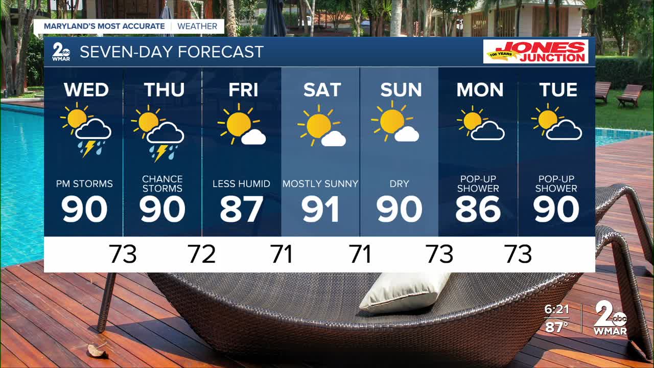
7 Day Forecast:
Wednesday A slight chance of showers and thunderstorms. Mostly cloudy, with a high near 90.
Wednesday Night A chance of showers and thunderstorms. Mostly cloudy, with a low around 73.
Thursday A chance of showers and thunderstorms. Partly sunny, with a high near 90.
Thursday Night A chance of showers and thunderstorms. Partly cloudy, with a low around 72.
Friday Mostly sunny, with a high near 89.
Friday Night Mostly clear, with a low around 71.
Saturday Mostly sunny, with a high near 89.
Saturday Night Mostly clear, with a low around 71.
Sunday Sunny, with a high near 93.
Sunday Night Mostly clear, with a low around 73.
Monday Mostly sunny, with a high near 92.
Monday Night Partly cloudy, with a low around 73.
Tuesday A chance of showers. Mostly sunny, with a high near 90.

