


BALTIMORE — Good Tuesday night!
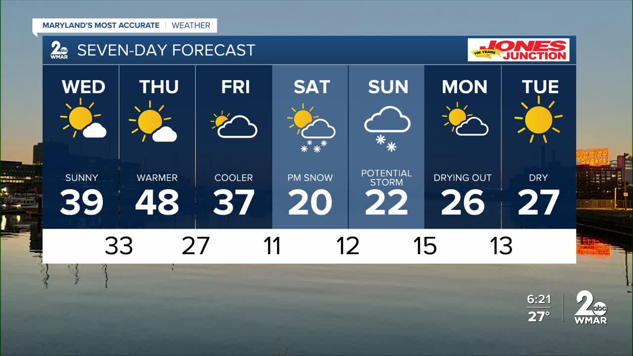
A sunny and warmer day is expected on Wednesday. Clouds will begin to increase later this week as we track our next potential major snowstorm heading into the weekend. The exact track of the storm remains uncertain, and that will ultimately determine snowfall amounts. At this time, the heaviest snow is expected to fall between Virginia and Washington, D.C. However, if the storm shifts farther north, much higher snow totals would be possible here in Maryland.
Now is a good time to prepare for extreme cold, accumulating snow, and potential travel difficulties.

7 Day Forecast:
Today Sunny, with a high near 27. West wind 5-15 mph, with gusts as high as 23 mph.
Tonight Clear, with a low around 14. Northwest wind around 5-10 mph becoming calm after midnight.
Wednesday Mostly sunny, with a high near 39.
Wednesday Night Mostly cloudy, with a low around 31.
Thursday Mostly sunny, with a high near 48.
Thursday Night Partly cloudy, with a low around 25.
Friday Partly sunny, with a high near 37.
Friday Night Mostly cloudy, with a low around 11.
Saturday A chance of snow. Mostly cloudy, with a high near 20.
Saturday Night Snow likely. Cloudy, with a low around 12.
Sunday Snow likely. Mostly cloudy, with a high near 22.
Sunday Night A chance of snow. Mostly cloudy, with a low around 11.
Monday Partly cloudy, with a high near 26.

