


Good Monday afternoon,
Our main weather focus this week will be on the potential for severe storms Tuesday afternoon and evening. These storms may contain hail, and damaging winds. My primary focus will be on the risk of heavy downpours. Some computer guidance suggests some of you will receive over an inch of rain Tuesday! If that happens all at one time, there could be some isolated flooding.

Once we get past Tuesday, the rest of the week will be smooth sailing! It'll be sunny, slightly cooler, and less humid! The 4th of July is looking dry as of now (knock on wood!), and we are hoping it remains that way!
Have a lovely week!
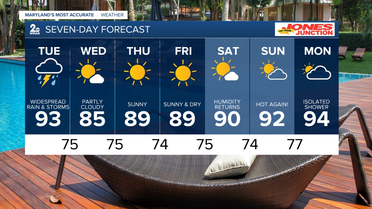
Tuesday A chance of showers. High near 92.
Tuesday Night Showers, with a low around 75.
Wednesday Mostly sunny, with a high near 88.
Wednesday Night Mostly clear, with a low around 75.
Thursday Sunny, with a high near 89.
Thursday Night Mostly clear, with a low around 74.
Independence Day Sunny, with a high near 86.
Friday Night Mostly clear, with a low around 65.
Saturday Sunny, with a high near 89.
Saturday Night Partly cloudy, with a low around 74.
Sunday Mostly sunny, with a high near 93.

