


BALTIMORE — Good Monday night!
We’ll finally climb above freezing on Tuesday for the first time since January 23rd—that’s 10 days ago! Unfortunately, the warmer temperatures won’t last long. A cold front will slide through Tuesday night, sending temperatures back down once again.
You’ll notice increasing clouds on Tuesday as a clipper system approaches from the west. Typically, systems moving in from the west are less of a concern, as the mountains tend to block much of the snow from reaching us. This system is no exception—most of the snow will remain over the mountains, with very little moisture left by the time it arrives here.
We’re expecting snow showers Tuesday night, with a quick dusting for most areas. That could lead to slick spots during the Wednesday morning commute. The snow should move out well before sunrise on Wednesday.
Stay warm,
Dylan


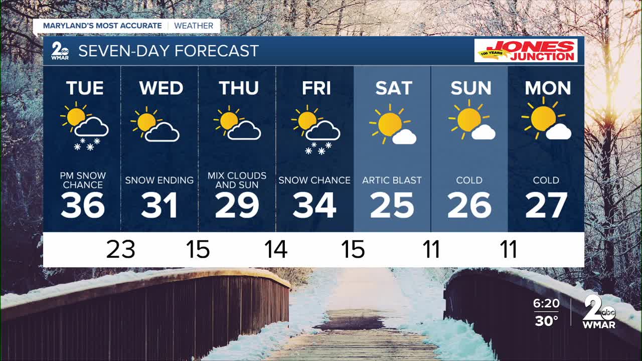
7 Day Forecast:
Tuesday A slight chance of snow. Partly sunny, with a high near 36.
Tuesday Night A chance of snow. Cloudy, with a low around 25.
Wednesday Mostly sunny, with a high near 33.
Wednesday Night Partly cloudy, with a low around 14.
Thursday Sunny, with a high near 29.
Thursday Night Partly cloudy, with a low around 13.
Friday A chance of snow. Mostly cloudy, with a high near 34.
Friday Night Partly cloudy, with a low around 12.
Saturday Sunny, with a high near 24.
Saturday Night Mostly clear, with a low around 8.
Sunday Mostly sunny, with a high near 25.
Sunday Night Partly cloudy, with a low around 10.
Monday Mostly sunny, with a high near 23.

