


BALTIMORE — Good Wednesday night!
Let’s jump right into an update on this weekend’s storm.
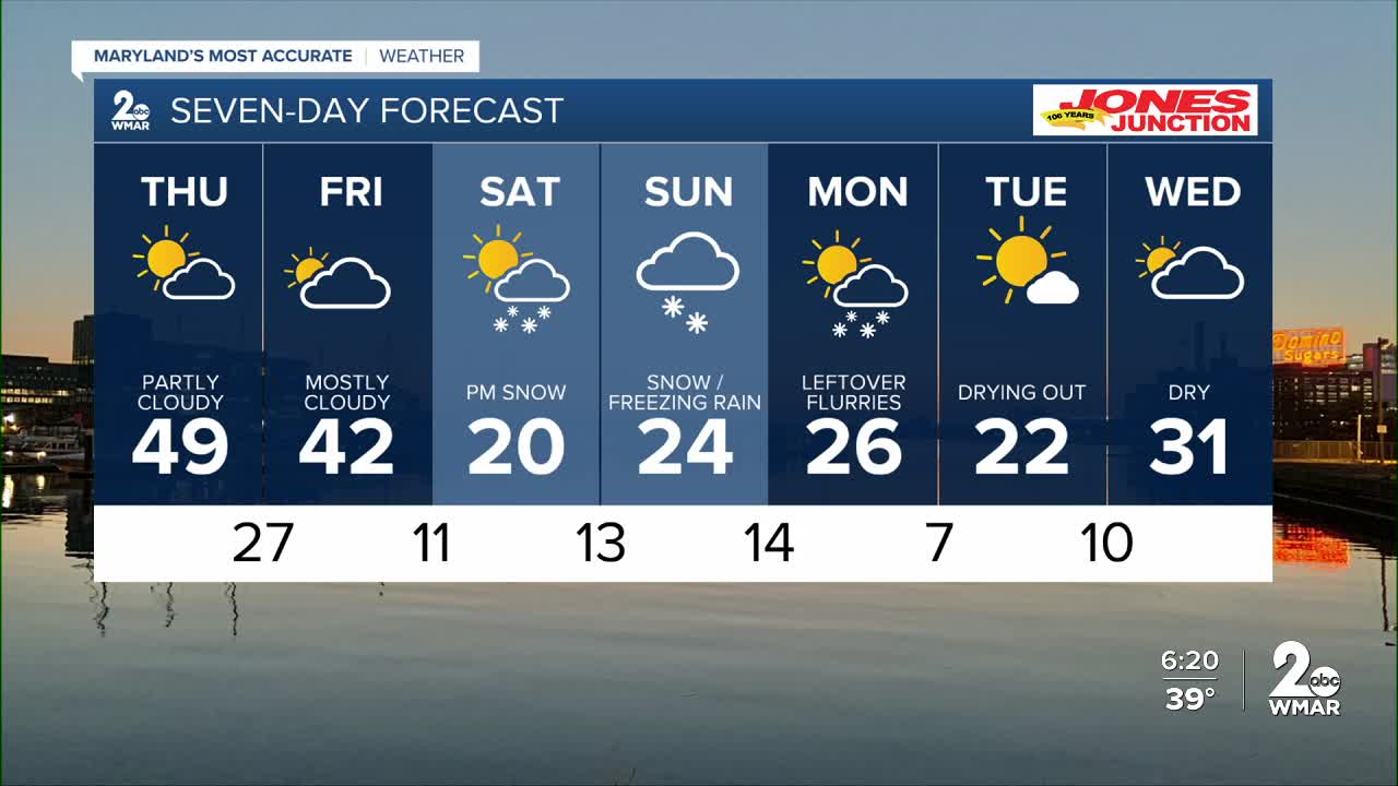
- Precipitation begins Saturday evening and continues through all of Sunday
- The storm track has shifted north, increasing the potential for freezing rain
- Areas that remain all snow could see up to a foot by the time it’s over
The next couple of days will be dry, but confidence is growing that a major winter storm will impact the region this weekend. Forecast models are largely in agreement on a farther-north track, which raises the risk for freezing rain—especially near the Chesapeake Bay and along the coast.
Snow totals will depend heavily on the exact track of the storm. A farther northwest shift would favor more freezing rain and lower snow totals, while a more southerly track would keep most areas all snow and allow totals to climb higher.
Regardless of the exact track, travel conditions will be hazardous from Saturday night through all of Sunday. Now is a good time to stock up on supplies and reconsider any travel plans.
— Dylan

7 Day Forecast:
Thursday Mostly sunny, with a high near 49.
Thursday Night Partly cloudy, with a low around 27.
Friday Mostly cloudy, with a high near 39.
Friday Night Mostly cloudy, with a low around 11.
Saturday A chance of snow. Mostly cloudy, with a high near 20.
Saturday Night Snow. Low around 13.
Sunday Snow. High near 21.
Sunday Night A chance of snow. Mostly cloudy, with a low around 14.
Monday Mostly sunny, with a high near 26.
Monday Night Mostly clear, with a low around 10.
Tuesday Sunny, with a high near 27.

