

Good Sunday evening,
We are carefully monitoring a line of showers and storms which will approach the region between 5pm-10pm tonight.
All modes of severe weather are possible, but the most likely threats would be damaging wind and flooding.
Behind the front, colder air ushers into Maryland by Monday morning. The clouds will be stubborn tomorrow, which means high temps will barely make it to the upper 70s! If you want a break from the heat - you'll love the next two days!
The shower threat will shift to southern Maryland Monday and Tuesday, with a stray shower to the north.
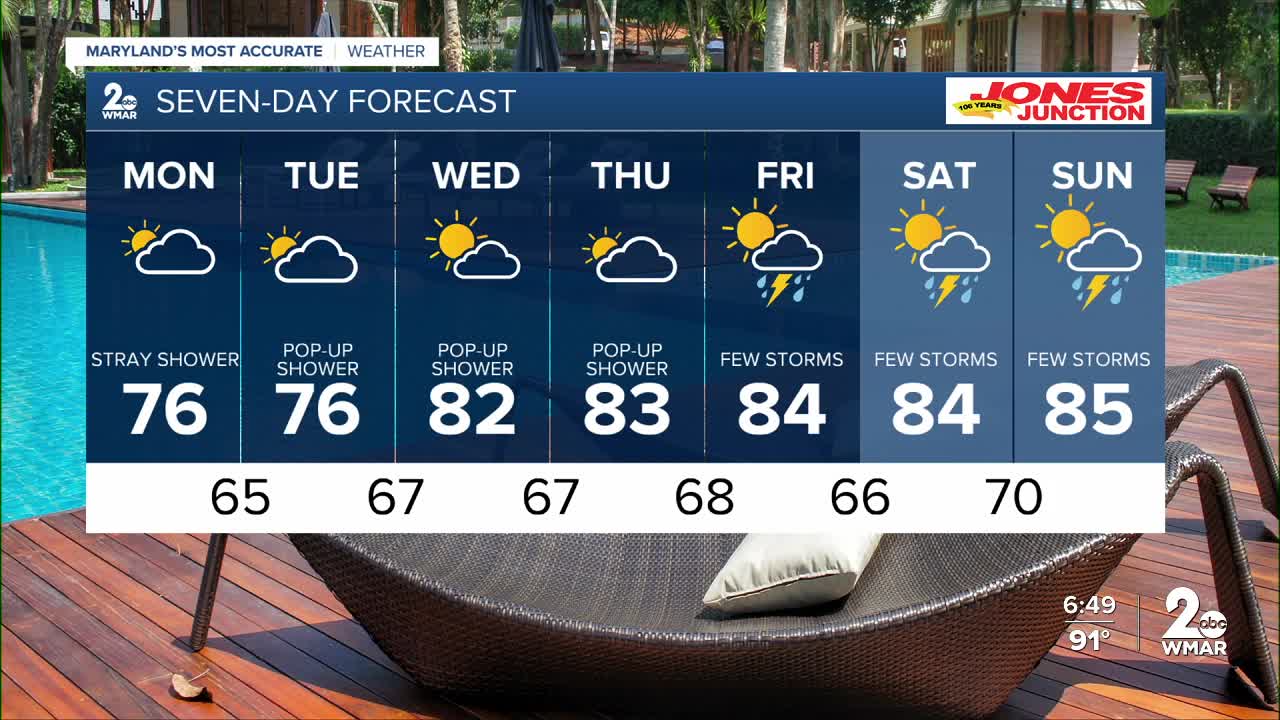
We will keep shower and storm chances around through most of this week and next weekend!


Monday
A slight chance of showers after 2pm. Cloudy, with a high near 77. Northeast wind 9 to 11 mph, with gusts as high as 21 mph. Chance of precipitation is 20%.
Monday Night
A chance of showers, mainly after 8pm. Mostly cloudy, with a low around 66. Northeast wind 6 to 8 mph. Chance of precipitation is 30%.
Tuesday
A slight chance of showers. Mostly cloudy, with a high near 77. East wind around 8 mph. Chance of precipitation is 20%.
Wednesday
Partly sunny, with a high near 82.
Wednesday Night
Partly cloudy, with a low around 67.
Thursday
Mostly sunny, with a high near 83.
Thursday Night
Partly cloudy, with a low around 66.
Friday
Mostly sunny, with a high near 84.

