


Good Sunday evening!
Talk about a lovely weekend! Temps were in the 70s/80s along with low humidity!
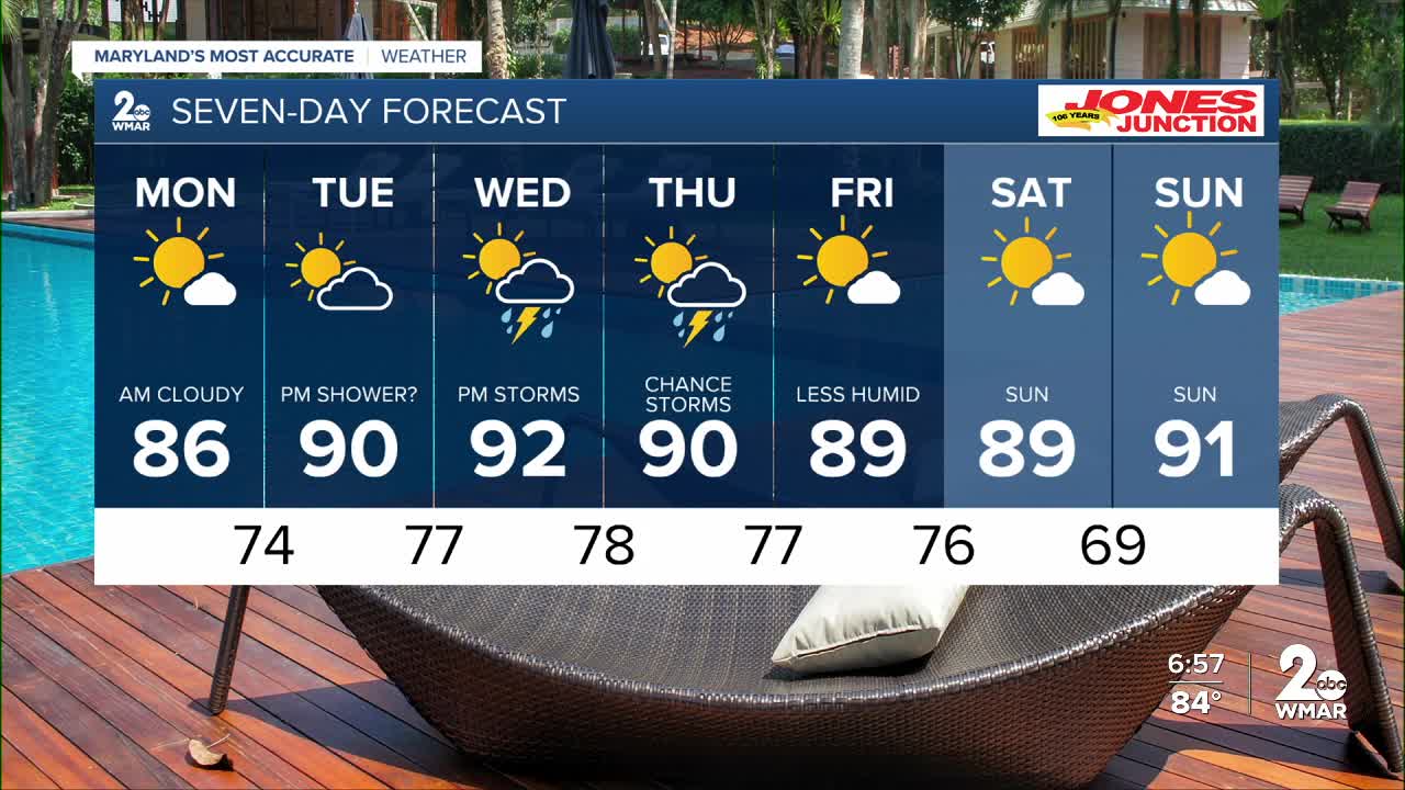
We will enjoy one more day (Monday) with cooler temps and low humidity before summer-like weather returns mid-week!
Expect a cloudy start to Monday, with afternoon sunshine!
High pressure slowly pushes offshore Tuesday - leading to the return of southerly flow. This southerly flow will usher in moisture from the south which will escalate storms chances later in the week.
Tuesday we'll see a slight chance of a pop-up storm to our south, then Wednesday and Thursday will be the two days with the highest likelihood of storms.
* Don't forget the Perseid Meteor Shower peaks Tuesday and Wednesday! Sky cover will be mostly clear Tuesday night, whereas I'm expecting quite a bit more cloud cover Wednesday night. Best time to get outside will be before moon rise which is at 9:55 pm Tuesday and 10:18 pm Wednesday!

Monday
Sunny, with a high near 87. Calm wind becoming southeast around 6 mph in the afternoon.
Tuesday
Sunny, with a high near 89. Calm wind becoming southeast 5 to 7 mph in the afternoon.
Wednesday
A slight chance of showers, then a chance of showers and thunderstorms after 2pm. Mostly sunny, with a high near 92. Chance of precipitation is 40%.
Thursday
A chance of showers and thunderstorms after 2pm. Partly sunny, with a high near 90. Chance of precipitation is 30%.
Friday
Sunny, with a high near 90.

