

BALTIMORE — Good Tuesday night!
Southerly winds will strengthen Wednesday, pushing temperatures into the 70s. Our attention then quickly turns to a strong cold front set to move through during the afternoon.
This front will bring showers and thunderstorms between 2 and 10 p.m. Wednesday, with the primary threats being heavy downpours and gusty winds up to 35 mph.
After the front moves through, the weather turns dry for several days, bringing plenty of sunshine through the weekend and into early next week. A classic “Omega Block” pattern will develop in the jet stream, leading to a stretch of unseasonably hot weather next week. Temperatures are expected to surge well into the 90s by next Tuesday!
Dylan

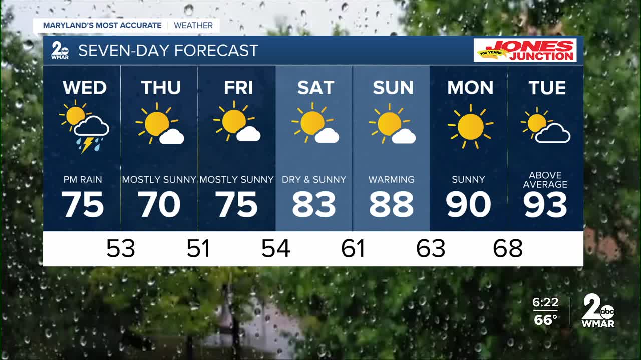
7 Day Forecast:
Wednesday Showers likely and possibly a thunderstorm. Partly sunny, with a high near 75.
Wednesday Night Showers and possibly a thunderstorm. Low around 53.
Thursday Mostly sunny, with a high near 70.
Thursday Night Partly cloudy, with a low around 51.
Friday Mostly sunny, with a high near 75.
Friday Night Partly cloudy, with a low around 54.
Saturday Mostly sunny, with a high near 83.
Saturday Night Partly cloudy, with a low around 61.
Sunday Sunny, with a high near 88.
Sunday Night Mostly clear, with a low around 63.
Monday Sunny, with a high near 90.
Monday Night Partly cloudy, with a low around 68.
Tuesday A chance of showers and thunderstorms. Mostly sunny, with a high near 93.

