


Good Sunday night!
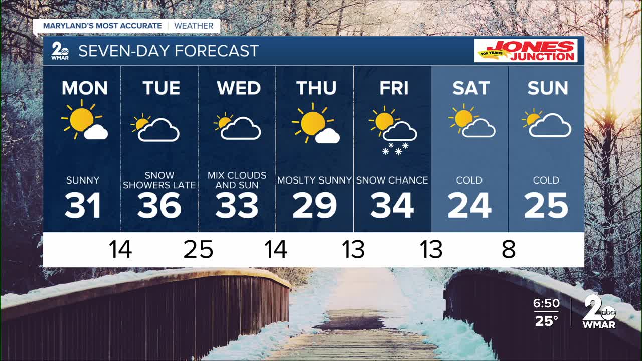
Today marks our ninth consecutive day below freezing, and we won’t climb above freezing again until Tuesday. High pressure remains in control Monday, delivering another sunny and gorgeous day. Temperatures finally rebound into the middle and upper 30s on Tuesday, but the warmup will be short-lived. A front diving south out of Canada will knock temperatures back into the 20s by late week.
We have two chances for snow, though neither appears promising for a blockbuster event. The first disturbance moves through Tuesday after sunset, bringing a few snow showers with the potential for a dusting to a half inch of accumulation. The second system arrives Friday—another fast-moving, moisture-starved clipper that is unlikely to produce much snow at all.
Enjoy the sunshine tomorrow,
Dylan

Monday
Sunny, with a high near 31. Wind chill values as low as -2. Northwest wind 7 to 11 mph, with gusts as high as 21 mph.
Monday Night
Partly cloudy, with a low around 16. West wind 3 to 7 mph.
Tuesday
Partly sunny, with a high near 36. West wind 3 to 5 mph.
Tuesday Night
A chance of snow, mainly after 1am. Mostly cloudy, with a low around 23. Light and variable wind. Chance of precipitation is 40%.
Wednesday
A slight chance of snow before 1pm. Partly sunny, with a high near 32. Chance of precipitation is 20%.
Wednesday Night
Partly cloudy, with a low around 14.
Thursday
Sunny, with a high near 30.
Thursday Night
Mostly clear, with a low around 14.
Friday
A chance of snow. Mostly cloudy, with a high near 34. Chance of precipitation is 40%.
Friday Night
Partly cloudy, with a low around 15.
Saturday
Sunny, with a high near 24.
Saturday Night
Mostly clear, with a low around 7.
Sunday
Mostly sunny, with a high near 24.

