


Good Sunday night!
We’ve got several weather changes headed our way over the next 24 hours — so let’s dive right in!
As of Sunday evening, satellite and radar imagery show a cold front sliding through central Maryland. As this front pushes from west to east, colder, drier air will clash with the warm, moist air ahead of it — sparking thunderstorm activity before midnight.

Once the front moves through, skies will clear on Monday and temperatures will take a noticeable dip. The real chill arrives Monday night, with lows dropping into the upper 20s in Baltimore City — and even colder readings farther away from the harbor.

There’s been some buzz about snow chances. While a stray flurry or two can’t be ruled out Monday night, I don’t expect any meaningful snow for central or eastern Maryland. If you catch a snowflake, consider yourself lucky — or unlucky, depending on how you feel about winter!
Our next headline comes Tuesday into Wednesday, as gusty winds kick in. Some models suggest sustained gusts could reach 25 to 35 mph at times — so hang onto your hats!

The good news? The weather calms down later this week, with sunshine and a nice warm-up by Thursday.

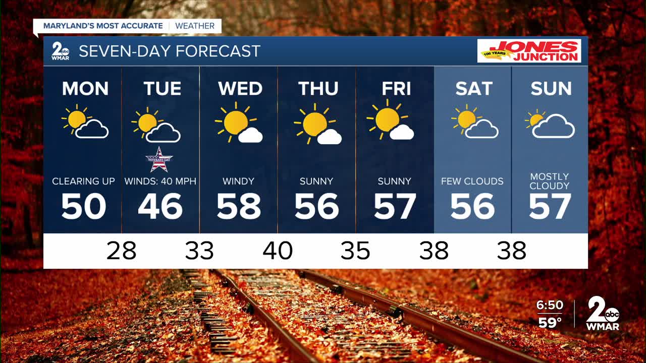
Monday
Partly sunny, with a high near 51. West wind 8 to 13 mph, with gusts as high as 24 mph.
Monday Night
Partly cloudy, with a low around 29. Northwest wind 9 to 13 mph, with gusts as high as 26 mph.
Veterans Day
Mostly sunny, with a high near 46. Breezy, with a west wind 14 to 20 mph, with gusts as high as 34 mph.
Tuesday Night
Mostly cloudy, with a low around 33. Southwest wind 7 to 9 mph, with gusts as high as 22 mph.
Wednesday
Mostly sunny, with a high near 58.
Wednesday Night
Partly cloudy, with a low around 40.
Thursday
Mostly sunny, with a high near 55.
Thursday Night
Mostly clear, with a low around 36.
Friday
Mostly sunny, with a high near 57.
Friday Night
Partly cloudy, with a low around 36.
Saturday
Mostly sunny, with a high near 53.
Saturday Night
Partly cloudy, with a low around 37.
Sunday
Mostly sunny, with a high near 57.

