


BALTIMORE — Good Monday evening!
After 10 consecutive dry days, rain showers return by the Tuesday-Thursday time frame.
Showers will be very sporadic Tuesday, and will mainly impact areas south of Baltimore. By Wednesday, a rather robust cold front will slide through the region, leading to more widespread rain. Rain amounts will be limited to around a quarter to half inch on Wednesday.
Showers linger Thursday before we dry things out for another fabulous weekend!


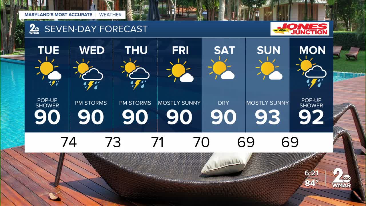
7 Day Forecast:
Tuesday A slight chance of showers and thunderstorms. Patchy fog. Otherwise, mostly sunny, with a high near 89.
Tuesday Night A slight chance of showers and thunderstorms. Partly cloudy, with a low around 74.
Wednesday A chance of showers, with thunderstorms also possible. Partly sunny, with a high near 91.
Wednesday Night A chance of showers and thunderstorms. Mostly cloudy, with a low around 73.
Thursday A chance of showers and thunderstorms. Partly sunny, with a high near 90.
Thursday Night A chance of showers and thunderstorms. Partly cloudy, with a low around 71.
Friday Sunny, with a high near 89.
Friday Night Partly cloudy, with a low around 70.
Saturday Mostly sunny, with a high near 89.
Saturday Night Mostly clear, with a low around 69.
Sunday Sunny, with a high near 91.
Sunday Night Mostly clear, with a low around 69.
Monday Partly sunny, with a high near 87.

