


Good morning, happy Thursday.
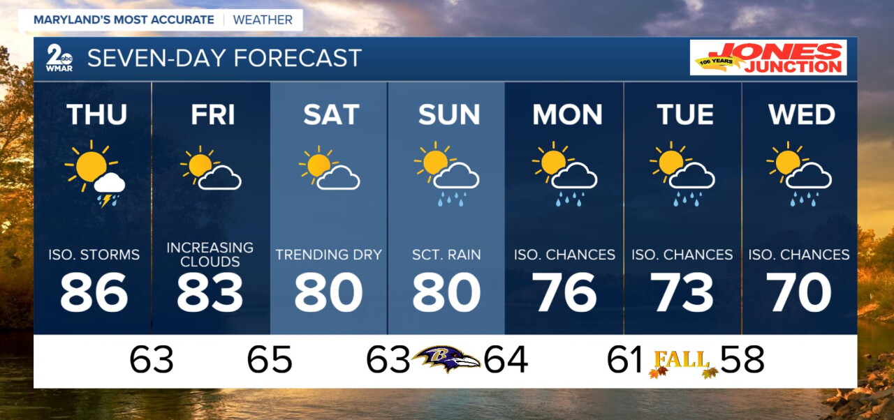
Cloudier start to our morning, with more rain potentially on the way. That slow moving cold front we have been watching now looks to make its way into the area later this afternoon. Mostly for our western portions of the state, but we could see a stray shower or storm approach us for the early evening hours of tonight. We are looking at our warmest day of the week with the middle to upper 80s possible. If we get rain and storms pushing in this will hinder temperatures for the afternoon. Following Thursday we will see cooler and slightly drier conditions until Sunday.
Overnight
Partly cloudy, with a low around 66. Calm wind.
Thursday
A chance of showers, with thunderstorms also possible after 5pm. Mostly sunny, with a high near 86.
Thursday Night
A chance of showers and thunderstorms before 11pm. Mostly cloudy, with a low around 63.
Friday
Mostly sunny, with a high near 83.
Friday Night
Partly cloudy, with a low around 65.
Saturday
Mostly sunny, with a high near 80.
Saturday Night
Mostly cloudy, with a low around 63.
Sunday
Showers likely and possibly a thunderstorm after 2pm. Mostly cloudy, with a high near 80.
Sunday Night
Showers likely and possibly a thunderstorm. Mostly cloudy, with a low around 64.
Monday
A chance of showers, mainly between 8am and 2pm. Partly sunny, with a high near 76.
Monday Night
A chance of showers and thunderstorms. Mostly cloudy, with a low around 61.
Tuesday
A chance of showers and thunderstorms. Mostly cloudy, with a high near 73.
Tuesday Night
A chance of showers and thunderstorms. Mostly cloudy, with a low around 58.
Wednesday
A chance of showers. Partly sunny, with a high near 70.

