

BALTIMORE — Good Monday night!
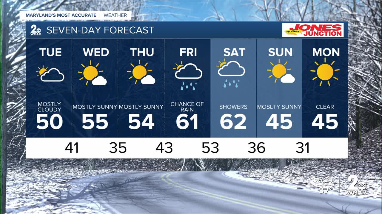
Tuesday will be mostly overcast and chilly, though we should catch a few peeks of sunshine late in the day.
High pressure builds in midweek, bringing bright, sunny skies for both Wednesday and Thursday — a nice stretch of quiet weather.
The big weather headline this week is a major warmup by Friday. Forecast models have been consistently hinting at temperatures climbing into the lower 60s on Friday and Saturday — warmth we really haven’t felt in a while. We did briefly touch 60 back around December 19th, but it only lasted for a day.
As nice as that warmth sounds, it won’t come with much sunshine. We’re tracking two storm systems for the Friday–Saturday timeframe. A warm front lifts north on Friday, followed by a cold front sweeping through on Saturday. While we’re still a few days out, it’s looking increasingly likely that rainfall totals could reach a half inch or more.
We’ll continue to fine-tune the details and keep you posted.
— Dylan
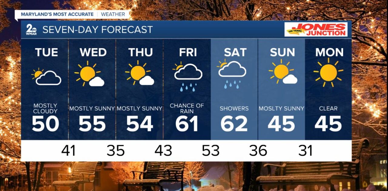
7 Day Forecast:
Tuesday Mostly cloudy, with a high near 50.
Tuesday Night Mostly cloudy, with a low around 41.
Wednesday Sunny, with a high near 55.
Wednesday Night Mostly clear, with a low around 35.
Thursday Mostly sunny, with a high near 54.
Thursday Night A chance of rain. Mostly cloudy, with a low around 43.
Friday A chance of rain. Mostly cloudy, with a high near 61.
Friday Night Rain likely. Mostly cloudy, with a low around 53.
Saturday Rain likely. Mostly cloudy, with a high near 62.
Saturday Night A chance of rain. Mostly cloudy, with a low around 36.
Sunday Mostly sunny, with a high near 45.
Sunday Night Partly cloudy, with a low around 28.
Monday Sunny, with a high near 45.

