


BALTIMORE — Good Tuesday evening,
Some beneficial rain came through the region today, and there's much more where that came from!
A low pressure system will cross the Tennessee Valley tomorrow, leading to several rounds of rain in the Mid-Atlantic over the next 2-3 days.
Our first burst of rain is expected Wednesday afternoon. These will be light showers, and we're not expecting any severe storms.
A more robust cold front slides through Thursday, delivering more rain to the region!

Heading into Friday, we begin to dry things out quite a bit! In fact, as of now we are keeping the weekend dry, albeit a stray shower is possible Saturday!

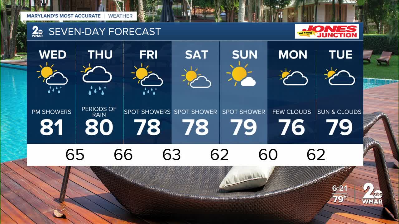
7 Day Forecast:
Wednesday A slight chance of showers. Mostly cloudy, with a high near 81.
Wednesday Night A slight chance of showers and thunderstorms. Cloudy, with a low around 65.
Thursday A chance of showers and thunderstorms. Mostly cloudy, with a high near 80.
Thursday Night Showers likely and possibly a thunderstorm. Cloudy, with a low around 66.
Friday A chance of showers. Mostly cloudy, with a high near 78.
Friday Night A chance of showers. Mostly cloudy, with a low around 63.
Saturday Partly sunny, with a high near 78.
Saturday Night Partly cloudy, with a low around 62.
Sunday Mostly sunny, with a high near 79.
Sunday Night Partly cloudy, with a low around 60.
Monday Partly sunny, with a high near 76.
Monday Night Mostly cloudy, with a low around 62.
Tuesday Mostly sunny, with a high near 79.

