


BALTIMORE — Happy Friday!
Clouds increase throughout the day with highs in the low to mid-60s, thanks to breezy southerly winds. Showers return to the area this evening as a cold front swings through. Rain chances increase around dinner time and linger through midnight. Saturday will be mostly rain-free with more sunshine and highs in the upper-60s. This will help temperatures climb back near 70°! Another system will be nearby Sunday, with a chance of spotty showers during the afternoon. The bottom line is that Sunday will NOT be a washout. It's important to mention that the high temperature on Sunday will occur early in the day, with much colder air arriving by Sunday afternoon. Temperatures will trend colder than normal early next week, with highs in the 40s!

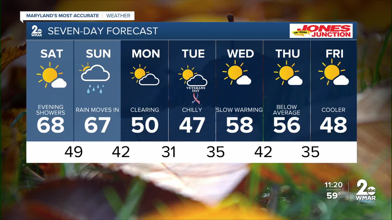
7 Day Forecast:
Friday Increasing clouds, with a high near 63. South wind 5-15 mph, with gusts as high as 24 mph.
Friday Night Showers. Low around 52. South wind 5-10 mph, with gusts as high as 21 mph.
Saturday Sunny, with a high near 68.
Saturday Night Partly cloudy, with a low around 49.
Sunday Rain likely. Mostly cloudy, with a high near 67.
Sunday Night Rain likely. Mostly cloudy, with a low around 42.
Monday Mostly sunny, with a high near 50.
Monday Night Partly cloudy, with a low around 31.
Veterans Day Sunny, with a high near 46.
Tuesday Night Partly cloudy, with a low around 35.
Wednesday Mostly sunny, with a high near 58.
Wednesday Night Partly cloudy, with a low around 41.
Thursday Sunny, with a high near 56.
Thursday Night Mostly clear, with a low around 35.
Friday Sunny, with a high near 48.

