


BALTIMORE — Get ready for a soaker Wednesday night into Thursday morning as a strong upper-level low pushes northwest of us.
Here's what we know:
Timing of heaviest rain: Starting after 11pm Wednesday night and ending around noon Thursday.
Rain amounts: A wide swath of 1-2" is likely with highest totals across western Maryland.
Wind: We are expecting winds to gust between 35 mph to 45 mph BOTH Thursday and Friday!
Alerts: Coastal Flood Warnings have been issued for areas along the Chesapeake Bay.
Due to all the wind and instability, there is a very slight chance of a weak spin up tornado. This is very unlikely!
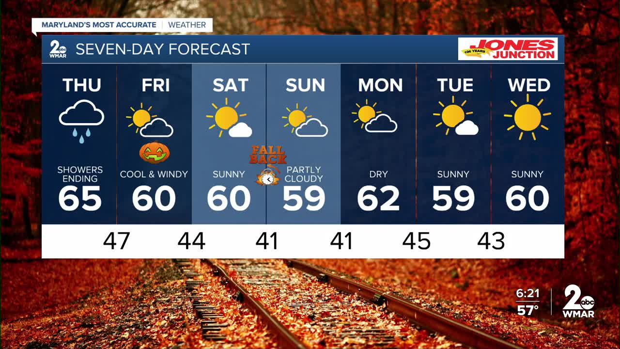
The rain is gone by Thursday afternoon, which leaves us with a dry Halloween!


7 Day Forecast:
Thursday Showers and possibly a thunderstorm, then showers likely. High near 65.
Thursday Night A chance of showers. Partly cloudy, with a low around 47.
Friday Sunny, with a high near 60. Breezy.
Friday Night Mostly clear, with a low around 44.
Saturday Sunny, with a high near 60.
Saturday Night Partly cloudy, with a low around 41.
Sunday Mostly sunny, with a high near 59.
Sunday Night Partly cloudy, with a low around 41.
Monday Mostly sunny, with a high near 62.
Monday Night Partly cloudy, with a low around 45.
Tuesday Mostly sunny, with a high near 59.
Tuesday Night Mostly clear, with a low around 43.
Wednesday Sunny, with a high near 60.

