


BALTIMORE — Satellite and radar imagery shows a weak cold front across the Appalachian Mountains, which will swing through between 9pm and midnight. This front is moisture starved, meaning little rainfall is associated with it. Less than a tenth of an inch of rain is expected Tuesday night! Meanwhile, the aforementioned frontal boundary will usher in colder weather for Wednesday, with highs only reaching the low 60s. Sunshine is expected Wed-Fri with nighttime lows dropping to the upper 30s in parts of the state, and the lower 40s closer to the Chesapeake Bay.
Stay warm!
Dylan

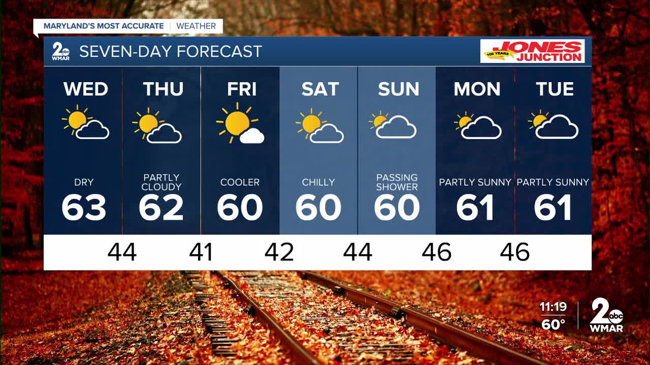
7 Day Forecast:
Wednesday Partly cloudy, with a high near 63.
Wednesday Night Mostly clear, with a low around 44.
Thursday Partly cloudy, with a high near 62.
Thursday Night Mostly clear, with a low around 41.
Friday Sunny, with a high near 61.
Friday Night Mostly clear, with a low around 42.
Saturday Partly cloudy, with a high near 60.
Saturday Night Partly cloudy, with a low around 44.
Sunday Partly sunny, with a high near 60.
Sunday Night Partly cloudy, with a low around 46.
Monday Partly sunny, with a high near 61.
Monday Night Partly cloudy, with a low around 46.
Tuesday Partly sunny, with a high near 61.

