


Good Thursday night!
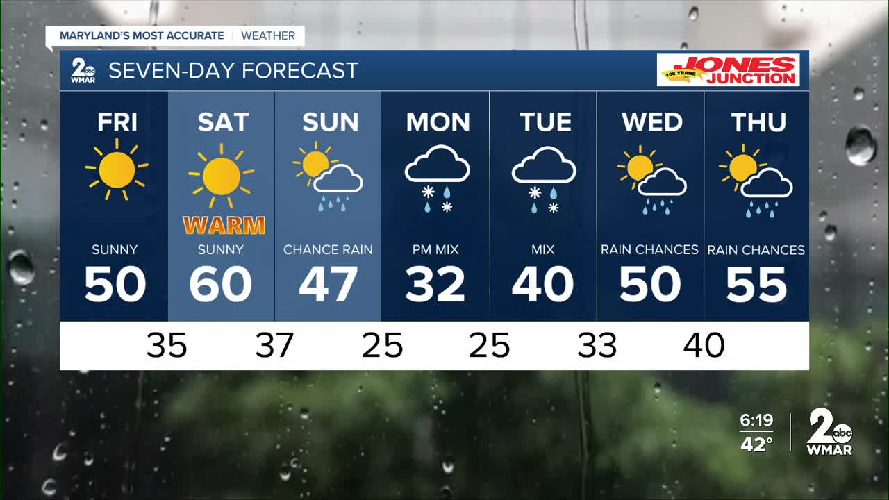
The rain will taper off later this evening, but thick cloud cover will linger through Friday morning. Sunshine returns by midday, clearing out the clouds and setting the stage for a beautiful finish to Friday and a gorgeous Saturday. It’ll feel more like spring this weekend, with highs climbing to around 60°F on Saturday!
Winter Weather Threat Next Week:
A cold front is expected to move through the region sometime between Sunday and Monday. Meanwhile, a strong ridge of high pressure will build to our north. Several disturbances may develop along this boundary from Sunday through Tuesday, bringing the potential for snow, sleet, and freezing rain.
The extent of any winter weather impacts will depend on how strong the high pressure becomes and how much moisture is available. While details are still coming into focus, anyone with travel plans Monday or Tuesday should stay tuned to the latest forecast updates.
Dylan

Friday Mostly sunny, with a high near 46.
Friday Night Partly cloudy, with a low around 32.
Saturday Sunny, with a high near 57.
Saturday Night Partly cloudy, with a low around 36.
Sunday Partly sunny, with a high near 47.
Sunday Night A chance of snow. Mostly cloudy, with a low around 28.
Monday A chance of rain and snow. Mostly cloudy, with a high near 37.
Monday Night A chance of rain and snow. Mostly cloudy, with a low around 25.
Tuesday A chance of rain and snow. Mostly cloudy, with a high near 37.
Tuesday Night Rain likely. Cloudy, with a low around 33.
Wednesday A chance of rain. Partly sunny, with a high near 49.

