


Good morning, happy Monday.
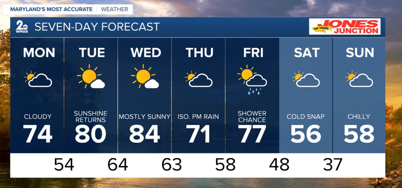
Lots are off school and work this morning, so as you kick back on your day off and plan your week, there are a few things of note ahead. Today looks cloudy, with drying skies. Tuesday brings some heat back into the region that lingers into Wednesday. Back to the cooler temperatures and rain chances for the end of the week as we see another system push through. Bitter cold for the end of the weekend and start of next week.
Overnight
Showers and possibly a thunderstorm. Low around 61.
Monday
Showers likely, mainly before 8am. Cloudy, then gradually becoming mostly sunny, with a high near 74.
Monday Night
Mostly clear, with a low around 55.
Tuesday
Sunny, with a high near 80.
Tuesday Night
Clear, with a low around 64.
Wednesday
Sunny, with a high near 84.
Wednesday Night
A slight chance of showers. Mostly cloudy, with a low around 63.
Thursday
A slight chance of showers after 2pm. Partly sunny, with a high near 71.
Thursday Night
A chance of showers, mainly after 2am. Mostly cloudy, with a low around 58.
Friday
A chance of showers and thunderstorms. Partly sunny, with a high near 77.
Friday Night
A slight chance of showers. Partly cloudy, with a low around 45.
Saturday
Mostly sunny, with a high near 56. Breezy.
Saturday Night
Mostly clear, with a low around 37.
Sunday
Sunny, with a high near 58.

