


BALTIMORE — A little seasonal whiplash tonight, as temps drop into the 40s! Grab your sweaters and jackets Thursday morning, as it'll be the coldest morning we've seen in a while. Sunglasses are a good idea, too, as sunshine returns to Maryland!
Our attention quickly turns to a potential coastal storm this weekend! As of now, models are in agreement that there will be a storm, but not in agreement on the track of the storm. A track farther east will keep us dry, and a track farther west will mean wind and rain for the Mid-Atlantic. The timing would mostly likely be late Saturday night into Sunday, but of course that is subject to adjustment as we get more data!


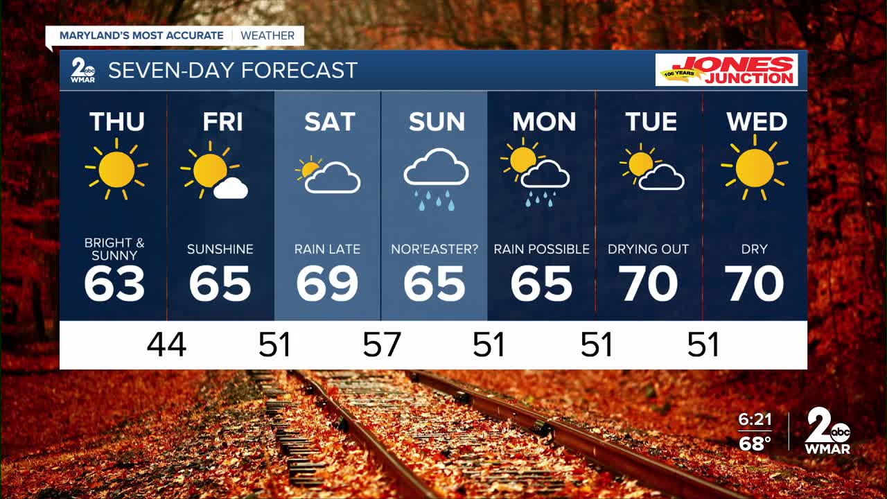
7 Day Forecast:
Thursday Sunny, with a high near 63.
Thursday Night Clear, with a low around 44.
Friday Sunny, with a high near 65.
Friday Night Partly cloudy, with a low around 51.
Saturday Partly sunny, with a high near 69.
Saturday Night A chance of showers. Mostly cloudy, with a low around 54.
Sunday A chance of showers. Partly sunny, with a high near 65.
Sunday Night A chance of showers. Mostly cloudy, with a low around 51.
Columbus Day A chance of showers. Partly cloudy, with a high near 65.
Monday Night Partly cloudy, with a low around 51.
Tuesday Mostly sunny, with a high near 68.
Tuesday Night Partly cloudy, with a low around 51.
Wednesday Mostly sunny, with a high near 68.

