


BALTIMORE — Good Monday night! The sunshine will stick with us for most of this week, along with a significant jump in the temperatures! It'll warm to the low 60s Tuesday, and eventually near 70° by Wednesday.
We are rain free during the work week, with rain chances returning this weekend as two separate cold fronts are slated to push through.
Typically in November we can expect the month to start out rather mild with high temps in the low 60s, with the month ending much cooler, with highs around 52°! Notice the average nighttime low dips close to freezing by the end of November. In terms of snowfall, we don't see much in November, with a measly average of just 0.01"!

Along with colder temperatures, our sunsets are becoming earlier! We are losing several minutes of daylight each week. In just two weeks the sun will go down at 4:50 pm!


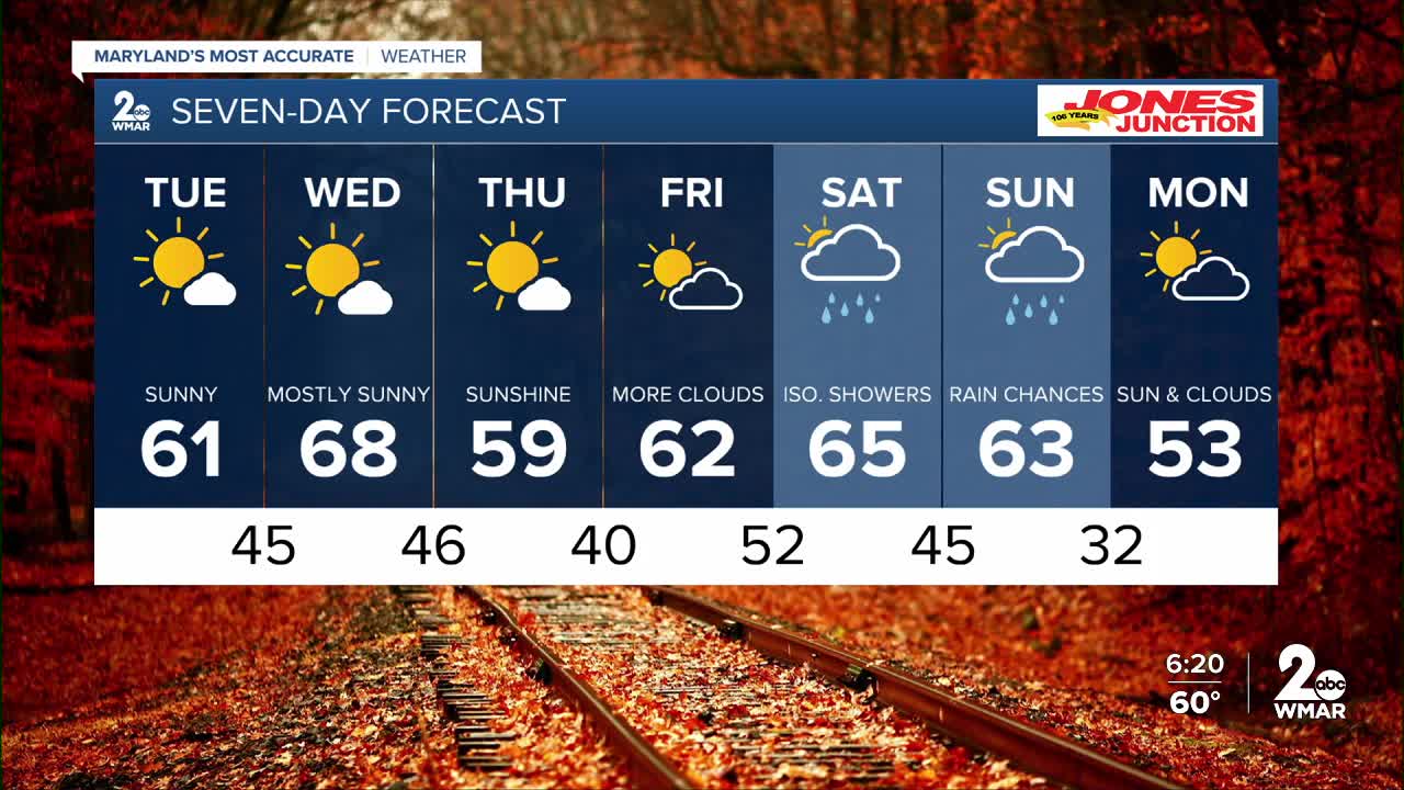
7 Day Forecast:
Tuesday Sunny, with a high near 62.
Tuesday Night Partly cloudy, with a low around 45.
Wednesday Sunny, with a high near 68.
Wednesday Night Mostly clear, with a low around 46.
Thursday Sunny, with a high near 62.
Thursday Night Mostly clear, with a low around 40.
Friday Mostly sunny, with a high near 63.
Friday Night A chance of rain. Mostly cloudy, with a low around 52.
Saturday Partly cloudy, with a high near 65.
Saturday Night Partly cloudy, with a low around 45.
Sunday A chance of rain. Partly sunny, with a high near 60.
Sunday Night Partly cloudy, with a low around 32.
Monday Mostly sunny, with a high near 57.

