


BALTIMORE — Friday will start off dry with occasional breaks of sunshine. However, a strong storm system is set to move in by the evening, bringing the potential for severe weather. Storms are expected to develop between 5 PM and midnight, with damaging winds and large hail being the primary threats. While the chance is low, an isolated tornado cannot be ruled out. Most areas can expect over an inch of rain, with some spots picking up as much as 1.5 inches.
Saturday will bring drier conditions overall, though a few scattered showers may linger throughout the day. As we head into next week, expect a return to more typical early June weather—warm and seasonable

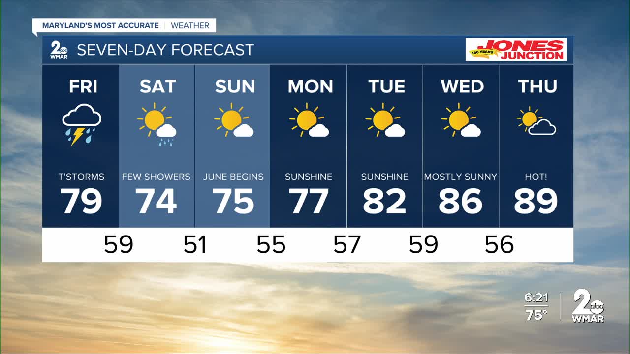
7 Day Forecast:
Friday Showers. Patchy fog. High near 78.
Friday Night Showers and possibly a thunderstorm. Low around 59.
Saturday Showers, with thunderstorms. High near 74.
Saturday Night A chance of thunderstorms. Mostly clear, with a low around 51.
Sunday Mostly sunny, with a high near 75.
Sunday Night Partly cloudy, with a low around 55.
Monday Sunny, with a high near 77.
Monday Night Mostly clear, with a low around 57.
Tuesday Sunny, with a high near 82.
Tuesday Night Mostly clear, with a low around 59.
Wednesday Mostly sunny, with a high near 84.
Wednesday Night Partly cloudy, with a low around 56.
Thursday Partly cloudy, with a high near 74.

