


BALTIMORE — Happy Thursday!
More smoke and sunshine are expected today with a noticeable easterly breeze! A stray pop-up shower cannot be ruled out this afternoon, but most areas will stay dry. Temperatures will rise into the low-80s with some lingering wildfire smoke from Canada.
While the smoke will stay in the upper levels of the atmosphere for the most part, those who are sensitive to poor air quality should use caution. The weekend will feature abundant sunshine with temperatures in the 80s. It will be a sizzling start to next week with highs climbing into the 90s!

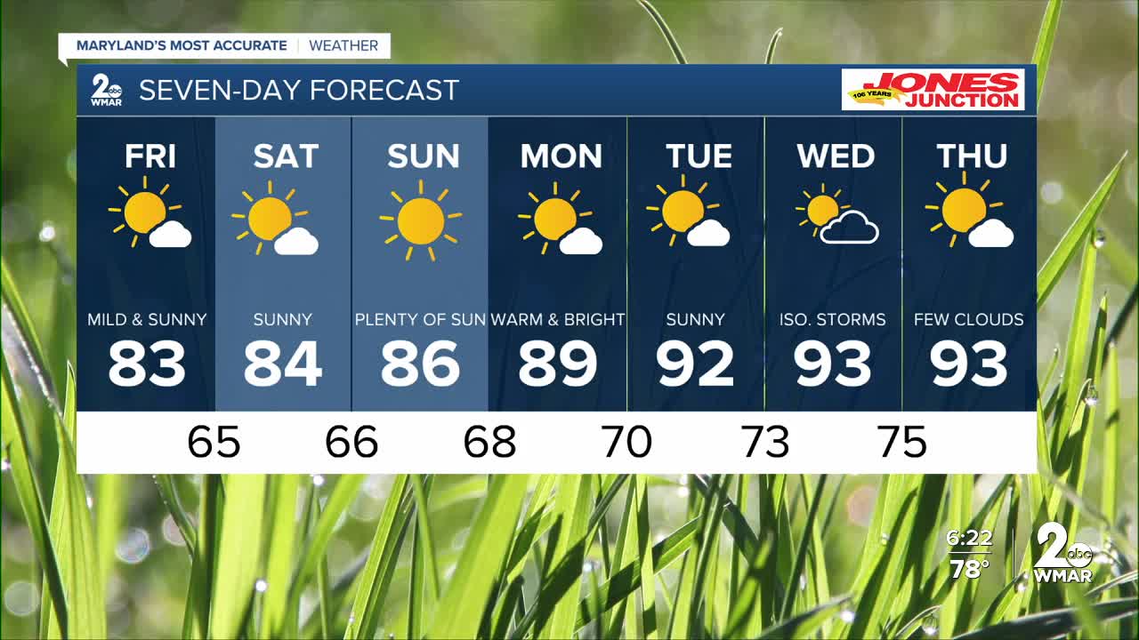
7 Day Forecast:
Today Partly cloudy, with a high near 83. East wind 8-12 mph, with gusts as high as 20 mph.
Tonight Mostly cloudy, then gradually becoming clear, with a low around 65. East wind 5-10 mph.
Friday Mostly sunny, with a high near 83.
Friday Night Mostly clear, with a low around 65.
Saturday Mostly sunny, with a high near 84.
Saturday Night Mostly clear, with a low around 66.
Sunday Sunny, with a high near 86.
Sunday Night Mostly clear, with a low around 68.
Monday Mostly sunny, with a high near 89.
Monday Night Mostly clear, with a low around 70.
Tuesday Mostly sunny, with a high near 92.
Tuesday Night Partly cloudy, with a low around 73.
Wednesday Partly cloudy, with a slight chance of a pop-up thunderstorm. A high near 93.
Wednesday Night Partly cloudy, with a low around 75.
Thursday Chance of showers. Mostly sunny, with a high near 93.

