


BALTIMORE — Widespread light to moderate rain showers continue into the overnight hours. Temperatures will stall into the upper-40s for most. An additional inch of rainfall could fall from the second system, especially east of I-95. Showers start to wrap early on Thursday. High pressure builds in for a short amount of time on Friday before our third system swings through this weekend. Temperatures will drop into the mid-50s this weekend with gusty northwest winds. A dry and windy start to next week before winds relax on Tuesday with ample sunshine and dry skies.
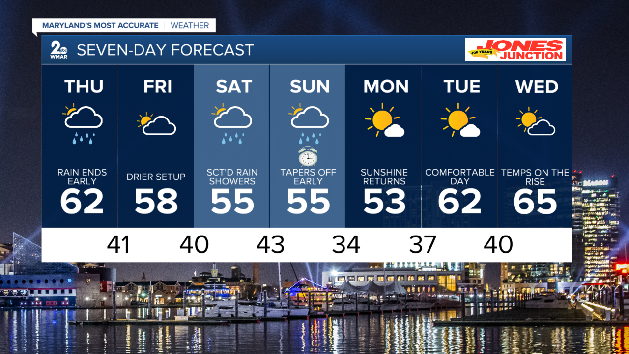
7 Day Forecast:
Tonight Rain. Low around 48. North wind 5-10 mph.
Thursday A chance of rain. Mostly cloudy, with a high near 62.
Thursday Night Partly cloudy, with a low around 41.
Friday Mostly cloudy, with a high near 58.
Friday Night A chance of rain. Mostly cloudy, with a low around 40.
Saturday Rain. High near 55.
Saturday Night Rain. Low around 43. Breezy.
Sunday Partly cloudy, with a high near 55. Breezy.
Sunday Night Partly cloudy, with a low around 34. Breezy.
Monday Mostly sunny, with a high near 53. Breezy.
Monday Night Mostly clear, with a low around 37. Breezy.
Tuesday Mostly sunny, with a high near 62.
Tuesday Night Mostly clear, with a low around 40. Breezy.
Wednesday Mostly sunny, with a high near 65.

