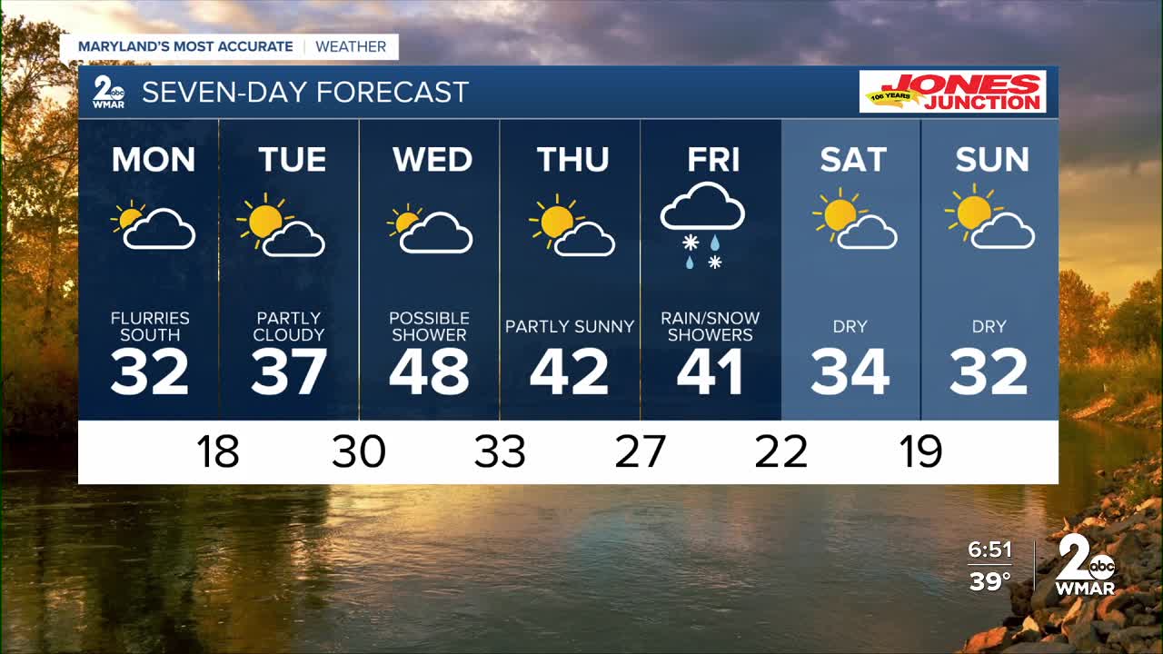


Bundle up over the next few days! A surge of Arctic air is set to deliver Maryland’s coldest night of the season (so far) on Monday night.
Temperatures in Baltimore City are expected to fall into the teens, with even colder readings likely farther west across Carroll and Frederick counties.
Cloud cover will increase Monday as a storm system tracks to our south. While that system will bring snow to extreme southern Maryland and northern Virginia, it is not expected to impact our immediate viewing area.
A secondary front will move through on Wednesday, offering a better chance for precipitation locally. However, temperatures will be too warm for snow—so expect conditions to be more wet than white.


Monday
Mostly cloudy, with a high near 32. North wind 8 to 10 mph, with gusts as high as 20 mph.
Monday Night
Mostly cloudy, then gradually becoming mostly clear, with a low around 18. Northeast wind around 5 mph becoming calm in the evening.
Tuesday
Mostly sunny, with a high near 37. Calm wind becoming south 5 to 8 mph in the afternoon.
Tuesday Night
Mostly cloudy, with a low around 30. Southwest wind around 7 mph.
Wednesday
A slight chance of rain. Mostly cloudy, with a high near 49. Chance of precipitation is 20%.
Wednesday Night
Mostly cloudy, with a low around 34.
Thursday
Mostly sunny, with a high near 45.
Thursday Night
A chance of rain and snow. Mostly cloudy, with a low around 29. Chance of precipitation is 40%.
Friday
A chance of rain and snow before 1pm. Partly sunny, with a high near 39. Chance of precipitation is 30%.
Friday Night
A chance of snow. Mostly cloudy, with a low around 21. Chance of precipitation is 30%.
Saturday
Mostly sunny, with a high near 34.
Saturday Night
Partly cloudy, with a low around 20.
Sunday
Mostly sunny, with a high near 32.

