


BALTIMORE — Good Tuesday night!
As expected, most of us saw rain today instead of snow.
BWI picked up 0.84" of rain, which would have translated to about 8.4" of snow had temperatures been colder.
After a dreary Tuesday, sunshine returns tomorrow — but the cold is here to stay for the foreseeable future.
We’re also monitoring a coastal storm expected to develop Friday afternoon, which looks like our next meaningful chance for precipitation. With plenty of cold air in place, this system has a much better shot at producing wintry weather. That said, confidence in the storm track remains low. Most models currently slide it far enough south to miss us entirely, while a few brush the southern tier of Maryland.
Either way, it’s a system worth watching as we head toward the weekend.
Best,
Dylan
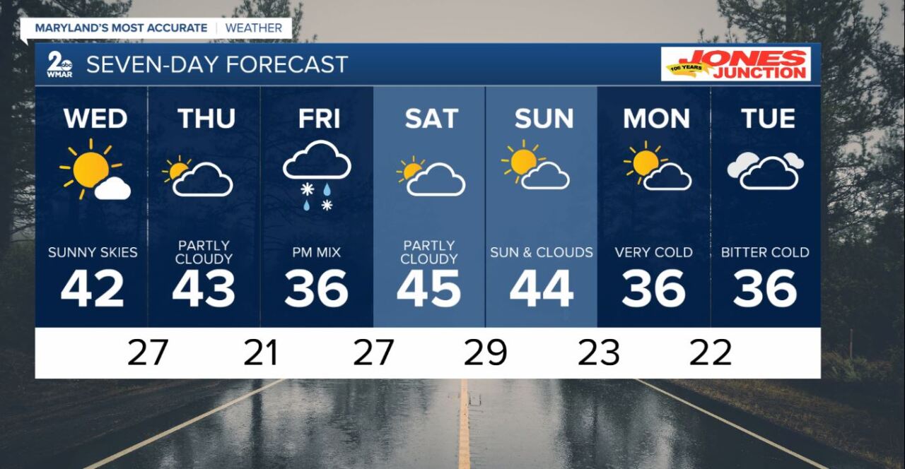
7 Day Forecast:
Wednesday Sunny, with a high near 42.
Wednesday Night Mostly clear, with a low around 27.
Thursday Partly sunny, with a high near 43.
Thursday Night Partly cloudy, with a low around 21.
Friday Partly sunny, with a high near 36.
Friday Night A chance of rain and snow. Mostly cloudy, with a low around 27.
Saturday Partly sunny, with a high near 45.
Saturday Night Mostly cloudy, with a low around 29.
Sunday Partly cloudy, with a high near 44.
Sunday Night Mostly cloudy, with a low around 23.
Monday Partly cloudy, with a high near 36.
Monday Night Partly cloudy, with a low around 21.
Tuesday Partly sunny, with a high near 36.

