


BALTIMORE — Good Tuesday night!
The coldest air of the winter has arrived and will remain in place through the weekend. Overnight temperatures will plunge into the single digits, with wind chills ranging from about -5 to -10 degrees. This is a good time to let your faucets drip to help prevent frozen pipes.
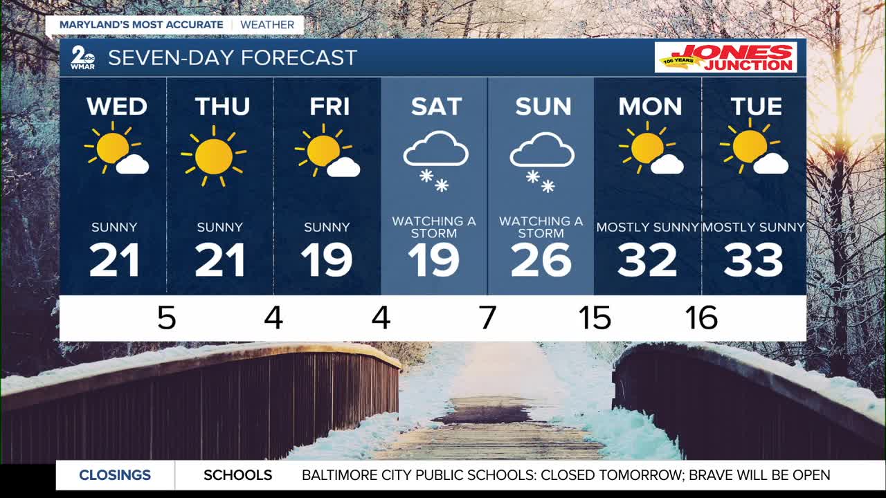
Looking ahead, our next storm system arrives this weekend, but there is still considerable uncertainty with the track. Our two most reliable models currently show very different solutions. That’s not unusual several days out, especially since the atmospheric features responsible for developing this storm have not yet moved into North America’s higher-resolution data network.
The bottom line: give us another 24 to 36 hours, and we’ll have a much clearer picture of the storm’s track and potential impacts.
Stay warm,
Dylan

7 Day Forecast:
Wednesday Increasing clouds, with a high near 22. Wind chill values as low as -3.
Wednesday Night Partly cloudy, with a low around 6.
Thursday Sunny, with a high near 21.
Thursday Night Mostly clear, with a low around 3.
Friday Mostly sunny, with a high near 19.
Friday Night Partly cloudy, with a low around 4.
Saturday Mostly cloudy, with a high near 20.
Saturday Night Mostly cloudy, with a low around 10.
Sunday Mostly cloudy, with a high near 26.
Sunday Night Partly cloudy, with a low around 15.
Monday Partly cloudy, with a high near 31.

