


BALTIMORE — Temperatures drop into the low to mid-30s this evening under broken cloud cover. Winds will increase overnight into Friday as an arctic cold front approaches. Winds will feel blustery on Friday, with gusts up to 35 mph at times. Highs will climb into the mid-40s. It will feel very cold on Saturday with temperatures in the 20s. Wintry weather is possible on Sunday afternoon/evening bringing a mix of snow mainly north and west and wintry mix to rain along the I-95 corridor. This is an evolving forecast.
Stay tuned!

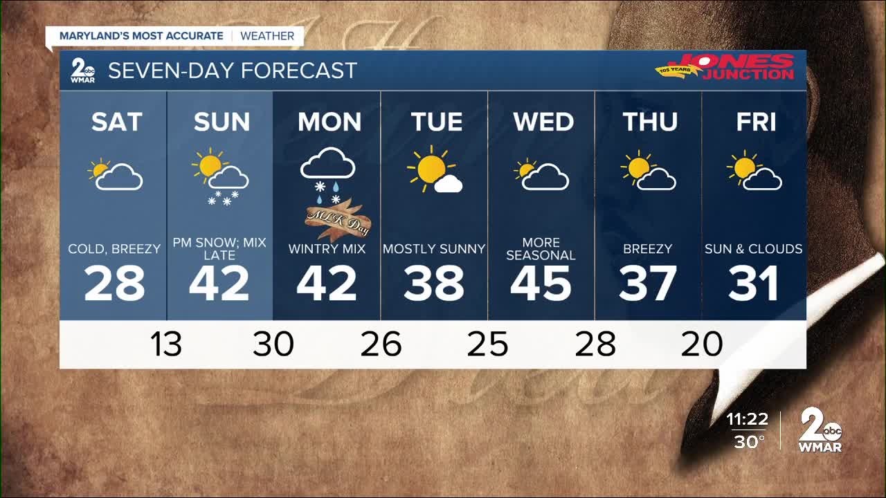
7 Day Forecast:
Tonight Mostly cloudy, with a low around 33. Light and variable wind becoming northeast around 5 mph after midnight.
Friday Mostly sunny, with a high near 47. Breezy, with a north wind 6 to 11 mph increasing to 15 to 20 mph in the afternoon. Winds could gust as high as 31 mph.
Friday Night Mostly clear, with a low around 16. North wind 10 to 18 mph, with gusts as high as 31 mph.
Saturday Increasing clouds, with a high near 27. North wind 9 to 11 mph, with gusts as high as 18 mph.
Saturday Night Mostly cloudy, with a low around 13. North wind 5 to 8 mph becoming calm after midnight.
Sunday A chance of snow, mainly after 2pm. Partly sunny, with a high near 38. Chance of precipitation is 50%.
Sunday Night A chance of snow before 8pm, then rain, snow, and freezing rain between 8pm and 2am, then rain and snow likely after 2am. Low around 28. Chance of precipitation is 80%.
M.L.King Day Rain and snow likely before 8am. Partly sunny, with a high near 43. Chance of precipitation is 60%.
Monday Night Partly cloudy, with a low around 25.
Tuesday Sunny, with a high near 38.
Tuesday Night Partly cloudy, with a low around 23.
Wednesday Partly sunny, with a high near 43.
Wednesday Night Mostly cloudy, with a low around 27.
Thursday Partly sunny, with a high near 39.

