


Good morning, happy Wednesday.
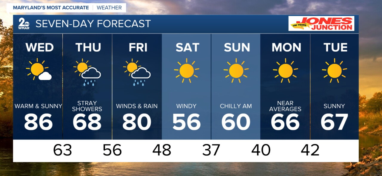
A little more to talk about as we go through your morning and afternoon hours today. Showers and a pop-up storm are possible for Wednesday as a weak front tries to slide through. Before the front, near record heat will drive temperatures into the middle 80s for highs. We quickly fall back to the 60s by Thursday, with winds picking up. A strong front moves in by Friday bringing bitter cold air to the region for the weekend.
Overnight
Mostly clear, with a low around 65.
Wednesday
Sunny, with a high near 86.
Wednesday Night
A slight chance of showers. Mostly clear during the early evening, then becoming mostly cloudy, with a low around 63.
Thursday
Showers likely, mainly after 2pm. Partly sunny, with a high near 68.
Thursday Night
A chance of showers. Cloudy, with a low around 56.
Friday
Showers likely after 2pm. Mostly cloudy, with a high near 80.
Friday Night
Showers likely, mainly before 8pm. Mostly cloudy, with a low around 48.
Saturday
Sunny, with a high near 56.
Saturday Night
Clear, with a low around 37.
Sunday
Sunny, with a high near 60.
Sunday Night
Mostly clear, with a low around 40.
Monday
Sunny, with a high near 66.
Monday Night
Partly cloudy, with a low around 42.
Tuesday
Mostly sunny, with a high near 67.

