



BALTIMORE — Happy Thursday!
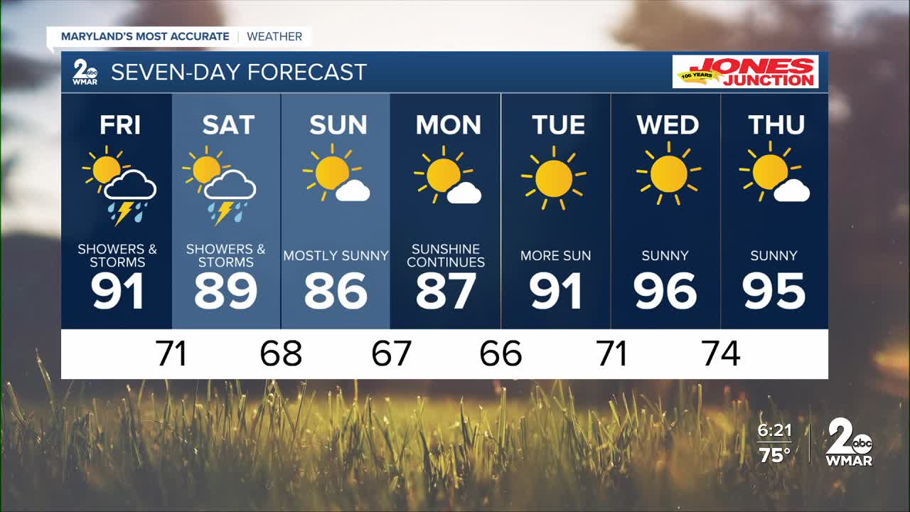
Clearing out for the night ahead as rain pushes east. Rain and storms are possible on Friday as well, with more heat and humidity. The chance for rain and storms extends into the first half of the weekend, with highs in the upper-80s on Saturday and Sunday. It will feel more pleasant with more sunshine through the first half of next week!
7 Day Forecast:
Today Showers and thunderstorms likely, then showers and possibly a thunderstorm. High near 89. South wind 5-10 mph.
Tonight Showers and thunderstorms. Low around 71. Light west wind.
Friday Showers likely and possibly a thunderstorm. Partly sunny, with a high near 91.
Friday Night Showers and thunderstorms likely. Mostly cloudy, with a low around 71.
Saturday A slight chance of showers and thunderstorms. Partly sunny, with a high near 89.
Saturday Night A chance of showers and thunderstorms. Mostly cloudy, with a low around 68.
Sunday Mostly sunny, with a high near 86.
Sunday Night Partly cloudy, with a low around 67.
Monday Mostly sunny, with a high near 87.
Monday Night Partly cloudy, with a low around 66.
Tuesday Sunny, with a high near 91.
Tuesday Night Mostly clear, with a low around 71.
Wednesday Sunny, with a high near 96.

