


BALTIMORE — Good Wednesday night!
Rain chances will continue through around 10 pm tonight with a few embedded thunderstorms. Some storms may contain strong wind and heavy rain, capable of producing flash flooding.
Rain chances dwindle by 10 pm or so, then we dry out overnight with a few leftover sprinkles.
Another round of showers are likely Thu. afternoon, but this round won't be as widespread.
We added the chance of a few stray showers on Friday, but so far we have kept the weekend dry!

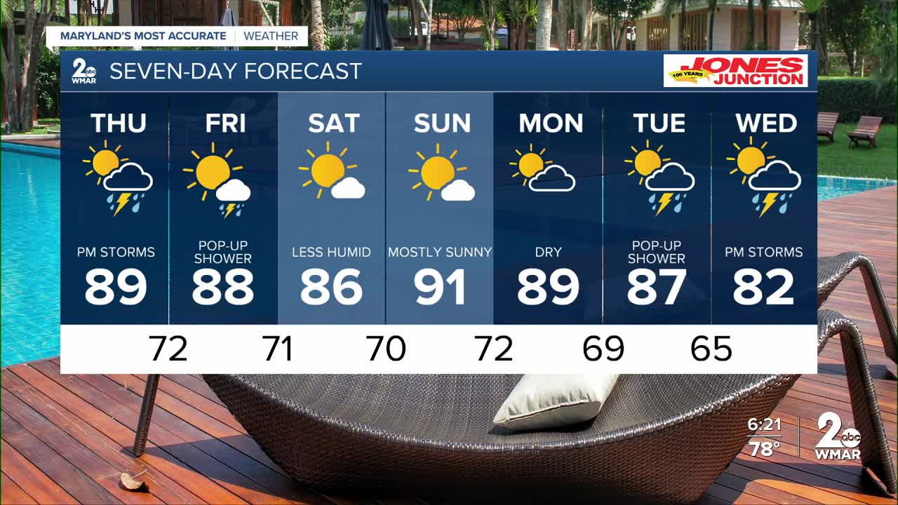
7 Day Forecast:
Thursday A slight chance of showers and thunderstorms. Partly cloudy, with a high near 90.
Thursday Night A chance of showers and thunderstorms. Partly cloudy, with a low around 72. Calm wind.
Friday Sunny, with a high near 89.
Friday Night Partly cloudy, with a low around 71.
Saturday Mostly sunny, with a high near 88.
Saturday Night Mostly clear, with a low around 71.
Sunday Sunny, with a high near 92.
Sunday Night Partly cloudy, with a low around 72.
Monday Partly cloudy, with a high near 89.
Monday Night Partly cloudy, with a low around 69.
Tuesday A chance of showers. Mostly sunny, with a high near 87.
Tuesday Night A chance of showers and thunderstorms. Partly cloudy, with a low around 65.
Wednesday A chance of showers. Mostly sunny, with a high near 93.

