


BALTIMORE — A Flash Flood Watch has been issued Thursday evening ahead of heavy rain! Here's what we know so far:
• Timing: 1pm until 7pm
• Amounts: 1-2" with isolated 2"+
• Other severe threats include damaging winds up to 57 mph
A cold front will slide down to the south and stall Thursday evening - delivering a plethora of rainfall. We have a level 3/4 risk of flooding.

Rain amounts will vary from location to location. Generally speaking, rain amounts increase the farther north you live.
The rain will go away Friday morning, however, cloudy skies and drizzle will linger through the morning. The clouds will keep the temps much cooler.
An early taste of September weather is expected this weekend with cooler air and lower humidity!

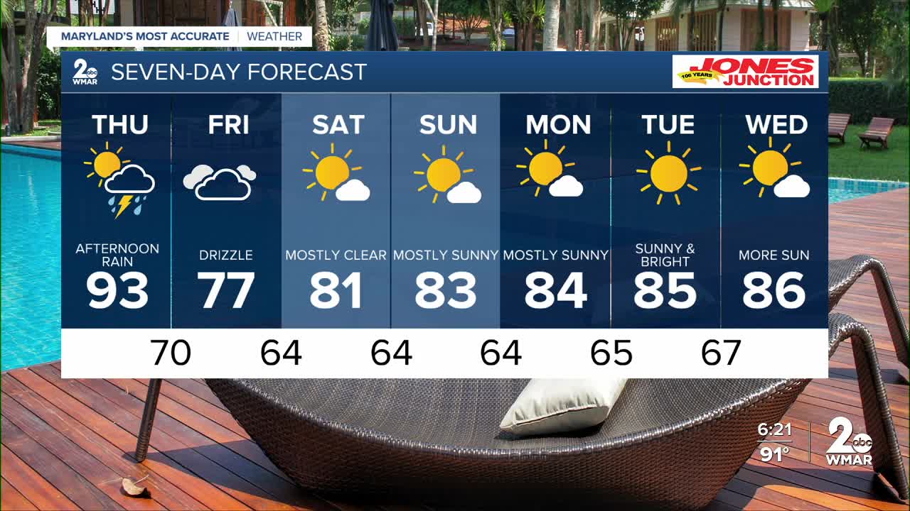
7 Day Forecast:
Thursday A chance of showers, then showers and thunderstorms. Increasing clouds, with a high near 93.
Thursday Night Showers and thunderstorms likely. Low around 70.
Friday A chance of showers and thunderstorms. Increasing clouds, with a high near 77.
Friday Night A chance of showers. Mostly cloudy, with a low around 64.
Saturday Sunny, with a high near 81.
Saturday Night Mostly clear, with a low around 64.
Sunday Sunny, with a high near 83.
Sunday Night Partly cloudy, with a low around 64.
Monday Mostly sunny, with a high near 84.
Monday Night Partly cloudy, with a low around 65.
Tuesday Partly cloudy, with a high near 85.
Tuesday Night Mostly cloudy, with a low around 67.
Wednesday A chance of showers. Partly sunny, with a high near 86.

