


BALTIMORE — Good Friday night!
Here’s the latest information on this weekend’s storm:
- Snow begins Saturday night between 8 PM and 11 PM
- Snowfall rates may reach 1–2 inches per hour
- Expect continuous snow from late Saturday night through late Sunday morning
- Snow transitions to sleet and freezing rain around midday Sunday
- The storm ends around midnight Sunday night
The highest risk for freezing rain appears to be along the Chesapeake Bay and the Delmarva Peninsula. Farther north—into northern Baltimore County and Carroll County—a transition to sleet looks more likely.
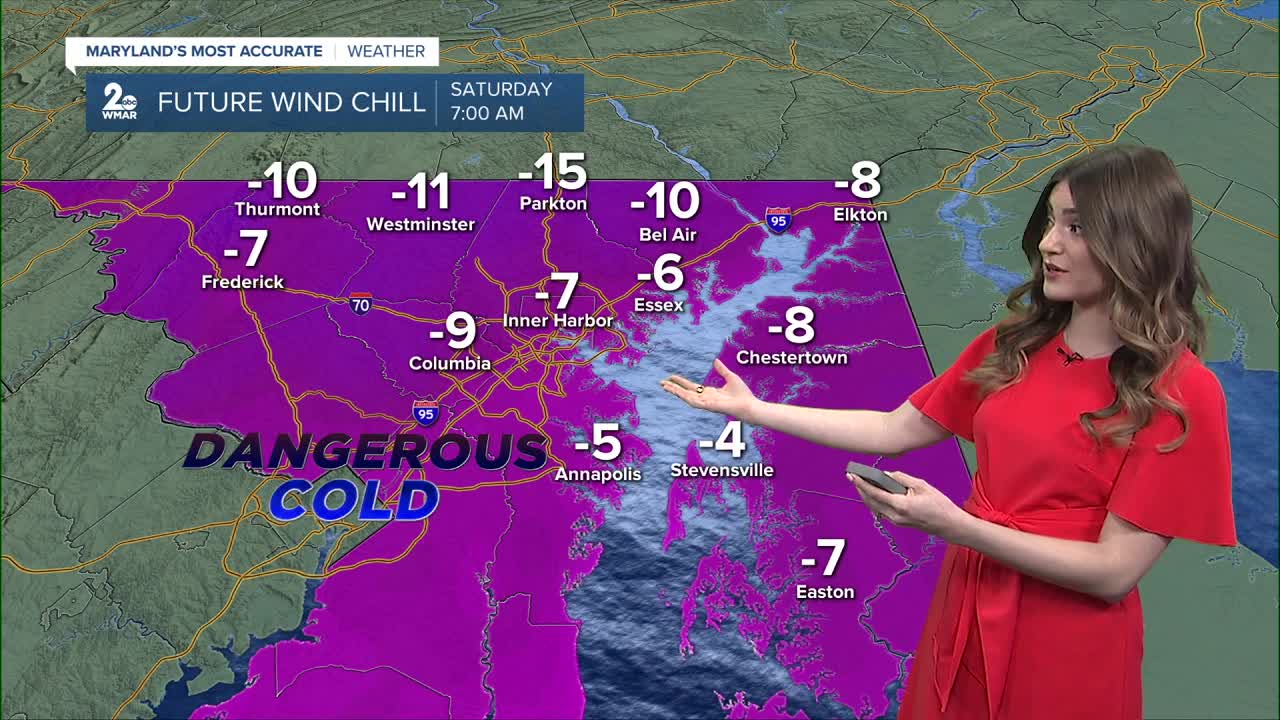
Following this weekend’s storm, one of the most prolonged cold stretches in years will move in. Nighttime lows will drop into the single digits, with wind chills below zero. Roads may remain icy for several days, as rock salt becomes far less effective below 15°F.
Expect plenty of sunshine next week, along with windy conditions.
Stay safe,
Dylan

7 Day Forecast:
Saturday Increasing clouds, with a high near 21. Wind chill values as low as -5.
Saturday Night Snow, possibly mixed with sleet. The snow could be heavy at times. Low around 16.
Sunday Snow, possibly mixed with sleet. The snow could be heavy at times. High near 27.
Sunday Night Snow, freezing rain, and sleet. Low around 19.
Monday A chance of snow. Partly sunny, with a high near 27.
Monday Night Mostly clear, with a low around 6.
Tuesday Sunny, with a high near 23.
Tuesday Night Partly cloudy, with a low around 9.
Wednesday Partly sunny, with a high near 26.
Wednesday Night Mostly cloudy, with a low around 9.
Thursday Partly sunny, with a high near 24.

