


BALTIMORE — Good Sunday night!
The storm is moving out of the region, but roads will remain icy over the next few days. Extreme cold will keep conditions slick—especially on bridges and overpasses.
Monday will start cloudy, with increasing sunshine by the afternoon. It will be windy, with gusts over 25 mph.
The rest of the week looks dry, with plenty of sunshine each day. Our main concern will be the extreme cold, especially late in the week. Temperatures will fall into the single digits, with wind chills as low as -10°F. Be sure to protect your pipes from freezing and let faucets drip overnight.
Stay warm,
Dylan

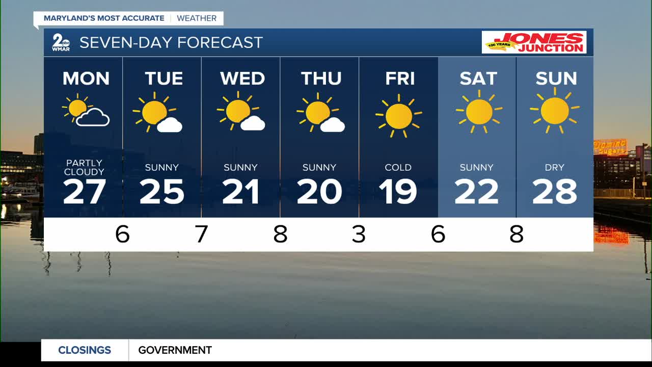
7 Day Forecast:
Monday Mostly sunny, with a high near 29.
Monday Night Mostly clear, with a low around 6.
Tuesday Sunny, with a high near 23.
Tuesday Night Partly cloudy, with a low around 7.
Wednesday Mostly sunny, with a high near 24.
Wednesday Night Mostly cloudy, with a low around 10.
Thursday Partly sunny, with a high near 23.
Thursday Night Mostly clear, with a low around 7.
Friday Mostly sunny, with a high near 22.
Friday Night Mostly clear, with a low around 10.
Saturday Mostly sunny, with a high near 26.

