


BALTIMORE — A COLD morning is expected Friday, as many of you will feel your coldest air since April!
Frost Advisories have been issued for Carroll and Frederick counties until 9AM Friday ahead of the cold! With a nighttime forecast low of 42° expected at Baltimore/Washington Thurgwood Marshall Airport, that will be our coldest temperature reading since April 28th if the forecast verifies!
The cold is short-lived as we return back to the 70s by Sunday! Our next storm system arrives Sunday evening, with showers developing around sunset. Rain is expected to taper off by sunrise Monday, with a quarter to half inch of precipitation expected!

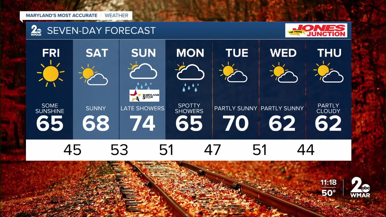
7 Day Forecast:
Friday Sunny, with a high near 65.
Friday Night Mostly clear, with a low around 45.
Saturday Partly sunny, with a high near 68.
Saturday Night Partly cloudy, with a low around 53.
Sunday A chance of showers. Partly sunny, with a high near 73.
Sunday Night Showers likely. Mostly cloudy, with a low around 51.
Monday A chance of showers before 8am. Mostly sunny, with a high near 67.
Monday Night Partly cloudy with a low around 47.
Tuesday Partly cloudy, with a high near 68.
Tuesday Night A chance of showers. Partly cloudy, with a low around 51.
Wednesday A chance of showers. Partly sunny, with a high near 67.
Wednesday Night Mostly clear, with a low around 44.
Thursday Partly cloudy, with a high near 59.

