


BALTIMORE — Good Wednesday evening!
The clouds and mist will linger overnight tonight, but the heavy rain has come to an end!
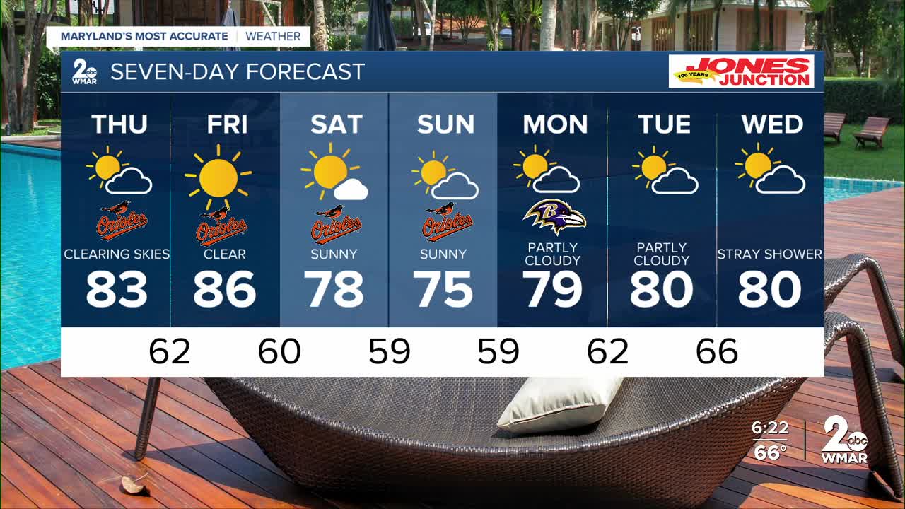
Expect a cloudy start to your Thursday, with sunshine developing by the early afternoon.
It'll be sunny and much warmer Thursday and Friday as high pressure builds in aloft!
The weekend stays dry, however, temps drop on Saturday as a cool front slides through!
Looking ahead, next week is trending seasonable, with partly cloudy skies most days and temps around 80°!
Have a good one!
Dylan

7 Day Forecast:
Thursday Mostly cloudy, then gradually becoming sunny, with a high near 81.
Thursday Night Mostly clear, with a low around 62.
Friday Sunny, with a high near 85.
Friday Night Mostly clear, with a low around 60.
Saturday Mostly sunny, with a high near 76.
Saturday Night Partly cloudy, with a low around 59.
Sunday Partly cloudy, with a high near 75.
Sunday Night Partly cloudy, with a low around 59.
Monday Partly cloudy, with a high near 77.
Monday Night Partly cloudy, with a low around 62.
Tuesday Partly cloudy, with a high near 80.
Tuesday Night Partly cloudy, with a low around 66.
Wednesday Mostly sunny, with a high near 82.

