

Good Friday night!
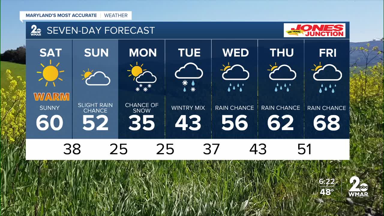
What a beautiful day we had! The pleasant weather sticks around through Saturday, with plenty of sunshine and unseasonably warm temperatures.
A cold front moves through on Sunday, bringing increased cloud cover and the chance for an isolated sprinkle or two. There have been a few minor adjustments to the forecast for Monday and Tuesday. Monday is now trending much drier than originally expected, with our next system arriving on Tuesday in the form of a wintry mix.
This system doesn’t look particularly impactful. Snowfall amounts appear light — generally a dusting up to a half inch at most. There is some potential for sleet and freezing rain, but I’m not anticipating major travel disruptions for two main reasons. First, the system is moisture-starved, so overall precipitation amounts should be limited regardless of type. Second, temperatures are expected to rise above freezing fairly quickly on Tuesday, transitioning any snow, sleet, or ice over to plain rain.
We’ll continue to keep you updated!
Have a great weekend!
Dylan

Saturday Sunny, with a high near 60.
Saturday Night Partly cloudy, with a low around 37.
Sunday Partly sunny, with a high near 47.
Sunday Night A chance of snow. Mostly cloudy, with a low around 25.
Monday A chance of rain and snow. Mostly cloudy, with a high near 32.
Monday Night A chance of rain and snow. Mostly cloudy, with a low around 25.
Tuesday A chance of rain and snow. Mostly cloudy, with a high near 40.
Tuesday Night Rain likely. Cloudy, with a low around 33.
Wednesday A chance of rain. Partly sunny, with a high near 50.
Wednesday Night Mostly cloudy, with a low around 40.
Thursday A chance of rain. Mostly cloudy, with a high near 55.

