


BALTIMORE — Our attention is focused on 'Erin' as the storm is expected to pass 300 miles off the Maryland coast Thursday morning.
Here's how Erin will impact our region:
• Winds gusting up to 30 mph Thursday morning
• Coastal Flood Advisoies issued in Anne Arundel County as winds may push water onshore resulting in minor flooding
• Large breaking waves up to 10-13' ft for MD/DE beaches
In addition to Hurricane Erin, an approaching frontal system will result in more clouds and drizzle Thursday.
The best two days will be Friday and Saturday as temps warm into the 80s under sunny skies!
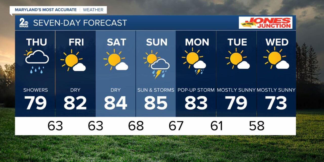
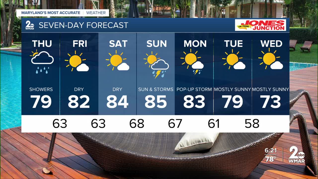
7 Day Forecast:
Thursday A slight chance of showers. Mostly cloudy, with a high near 79. Northeast wind 5-15 mph, with gusts as high as 25-30 mph.
Thursday Night Partly cloudy, with a low around 63.
Friday Mostly sunny, with a high near 82.
Friday Night Mostly clear, with a low around 63.
Saturday Mostly sunny, with a high near 84.
Saturday Night Partly cloudy, with a low around 68.
Sunday A chance of showers. Partly cloudy, with a high near 85.
Sunday Night A chance of showers. Mostly cloudy, with a low around 67.
Monday Mostly sunny, with a slight chance of an isolated shower and thunderstorm. A high near 83.
Monday Night Partly cloudy, with a low around 61.
Tuesday Mostly sunny, with a high near 79.
Tuesday Night Partly cloudy, with a low around 58.
Wednesday Mostly sunny, with a high near 73.

