



Good Sunday night!
I'm meteorologist Dylan Robichaud. Luckily, the rain held off through most of today, but some areas of patchy drizzle can be expected through the nighttime hours.
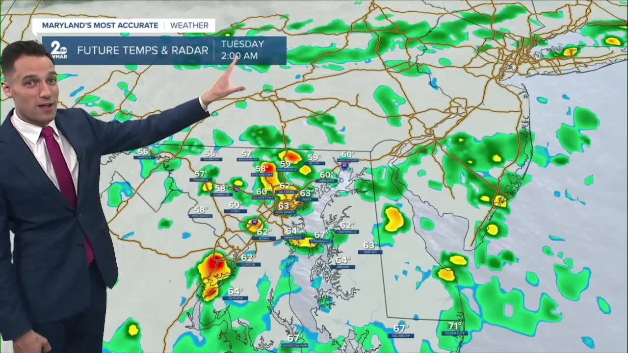
Expect on and off showers on Monday, with more widespread heavier rain arriving to the area Monday night into Tuesday. The wettest day of the week will be Tuesday, followed by gradual improvements by Wednesday.
A significant drop to both the temperatures and humidity are expected this week as a dip in the jet stream ushers in cooler air from the north. It'll also be quite windy over the next few days, with winds between 10-20 mph.
Dylan

Monday
Scattered showers after 2pm. Mostly cloudy, with a high near 71. Northeast wind 9 to 13 mph. Chance of precipitation is 30%.
Monday Night
Showers, mainly after 8pm. Low around 56. East wind around 9 mph. Chance of precipitation is 90%. New precipitation amounts between a tenth and quarter of an inch possible.
Tuesday
Showers and possibly a thunderstorm. High near 62. Northeast wind 13 to 16 mph, with gusts as high as 21 mph. Chance of precipitation is 90%.
Tuesday Night
Showers likely. Cloudy, with a low around 52. Chance of precipitation is 70%.
Wednesday
A chance of showers. Mostly cloudy, with a high near 61. Chance of precipitation is 40%.
Wednesday Night
A chance of showers, mainly before 2am. Mostly cloudy, with a low around 51. Chance of precipitation is 30%.
Thursday
A chance of showers, mainly between 8am and 2pm. Mostly cloudy, with a high near 62. Chance of precipitation is 30%.
Thursday Night
Mostly cloudy, with a low around 49.
Friday
Mostly sunny, with a high near 64.
Friday Night
Partly cloudy, with a low around 50.
Saturday
A slight chance of showers. Mostly sunny, with a high near 68. Chance of precipitation is 20%.
Saturday Night
Mostly cloudy, with a low around 52.
Sunday
A slight chance of showers. Mostly sunny, with a high near 72.

