


BALTIMORE — Happy Friday!
More sunshine today with warm temperatures, in the upper-70s and low-80s. Our next round of rain pushes northward on Saturday, leading to widespread showers. Drying out on Sunday as a high-pressure system filters in from the north. High temperatures will trend cooler this weekend, with highs in the mid-70s. Temperatures will continue to fall throughout next week. There is still plenty of uncertainty with how far north the tropical moisture will travel. The model guidance hints that soon-to-be Imelda could move inland over the Carolina's on Monday or Tuesday. The track and intensity of the rain across the Mid-Atlantic remains uncertain, but models pinpoint the heaviest rain to the south of the Baltimore area. Stick with Maryland's Most Accurate weather team for updates!

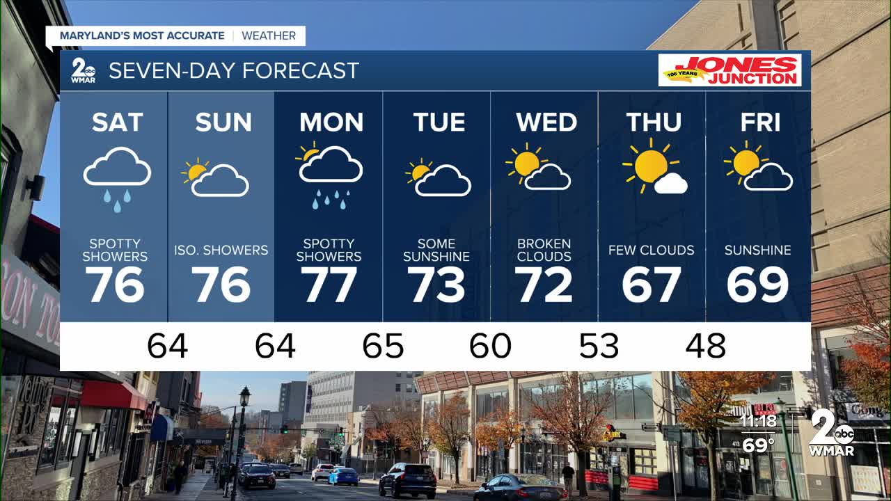
7 Day Forecast:
Today Patchy fog in the morning. Otherwise, mostly sunny, with a high near 81. Calm wind becoming northwest around 5-10 mph in the afternoon.
Tonight Partly cloudy, with a low around 64. Calm wind.
Saturday A chance of showers. Mostly cloudy, with a high near 76.
Saturday Night Showers likely. Cloudy, with a low around 64.
Sunday A chance of showers. Mostly cloudy, with a high near 76.
Sunday Night Mostly cloudy, with a low around 64.
Monday A chance of showers. Mostly cloudy, with a high near 77.
Monday Night A chance of showers. Cloudy, with a low around 65.
Tuesday Mostly cloudy, with a high near 73.
Tuesday Night Mostly cloudy, with a low around 60.
Wednesday Partly cloudy, with a high near 72.
Wednesday Night Partly cloudy, with a low around 53.
Thursday Mostly sunny, with a high near 67.
Thursday Night Partly cloudy, with a low around 48.
Friday Mostly sunny, with a high near 69.

