


BALTIMORE — The official high temperature at BWI was 97° today, which fell just shy of the record of 98° set back June of 2024. The Inner Harbor reached an astounding 104° today! That's because of the urban Heat Island Effect! The asphalt and concrete absorb solar radiation, making temperatures unbearably hot!
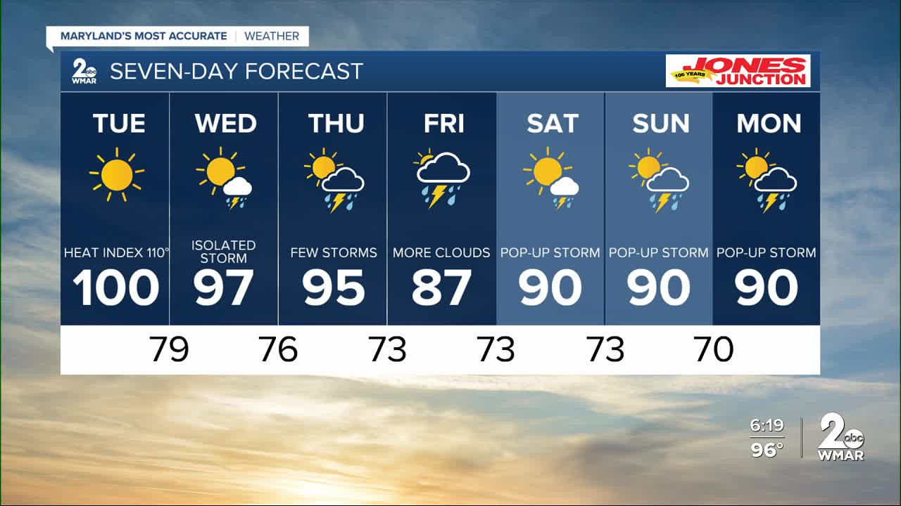
We have one more day of temperatures reaching the century mark (Tuesday), then we cool it down a tad bit on Wed and Thu. The heat wave finally breaks on Friday, as cloud cover will be thicker, making things cooler!
We are dry Tuesday, then see the return of late afternoon showers and storms returning Wednesday and lasting through Sunday, with the best likelihood of rain being Friday and Saturday.


7 Day Forecast:
Tuesday Sunny and hot, with a high near 100. Heat index values as high as 109.
Tuesday Night Mostly clear, with a low around 79.
Wednesday A slight chance of showers and thunderstorms. Mostly sunny and hot, with a high near 99.
Wednesday Night A chance of showers and thunderstorms. Partly cloudy, with a low around 76.
Thursday A chance of showers and thunderstorms. Mostly sunny, with a high near 95.
Thursday Night A chance of showers and thunderstorms. Mostly cloudy, with a low around 73.
Friday A chance of showers and thunderstorms. Partly cloudy, with a high near 89.
Friday Night A chance of showers and thunderstorms. Mostly cloudy, with a low around 73.
Saturday A chance of showers and thunderstorms. Partly cloudy, with a high near 91.
Saturday Night A chance of showers and thunderstorms. Mostly cloudy, with a low around 73.
Sunday A chance of showers and thunderstorms. Partly cloudy, with a high near 90.
Sunday Night A chance of showers and thunderstorms. Mostly cloudy, with a low around 74. Chance of precipitation is 30%.
Monday A chance of showers and thunderstorms. Mostly sunny, with a high near 92.

