


Good Monday evening!
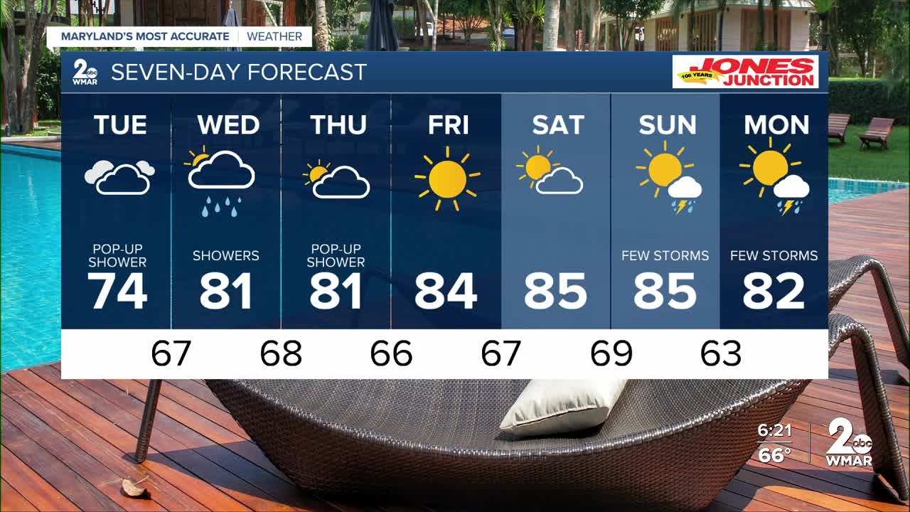
The clouds will keeps us cool for one more day! Highs will barely get above 70° on Tuesday along with clouds and patchy drizzle, especially along the Eastern Shore!
Rain chances become more abundant Wednesday as a front slides in across the region! Then we see dry and sunny weather returning late this week into the weekend!

Quick house keeping note for you! Our last 8pm sunset was this weekend. We've lost 82 minutes of daylight since the summer solstice, and won't see another sunset at 8pm until May 1st!


7 Day Forecast:
Tuesday A slight chance of showers. Partly sunny, with a high near 75.
Tuesday Night Mostly cloudy, with a low around 67.
Wednesday A slight chance of showers. Partly sunny, with a high near 81.
Wednesday Night Partly cloudy, with a low around 68.
Thursday Mostly sunny, with a high near 83.
Thursday Night Partly cloudy, with a low around 67.
Friday Sunny, with a high near 84.
Friday Night Partly cloudy, with a low around 67.
Saturday Mostly sunny, with a high near 85.
Saturday Night Partly cloudy, with a low around 69.
Sunday A chance of showers. Partly sunny, with a high near 85.

