


BALTIMORE — Good Thursday night!
After a gorgeous day with lots of sunshine, our next cold front arrives Friday night, bringing showers to the region.
We're looking at rain chances Friday night between 7pm-1am, with under a quarter inch of precipitation expected!


We dry out for Saturday, and with the return of southerly winds, we warm back to near 70°!
Another system will be nearby Sunday, however, the models are showing a rather disorganized system, with little precipitation forming as well. The bottom line is that Sunday will NOT be a washout, and I wouldn't cancel outdoor plans due to rain. It's important to mention that the high temperature on Sunday will occur early in the day, with much colder air arriving by Sunday afternoon. This is in response to a big dip in the jet stream, which will bring our temperatures down by Monday.
Snow showers are possible across western Maryland on Sunday evening above 2,000' ft. By the time the cold air reaches central and eastern Maryland, the moisture will be gone, which should keep us snow free.

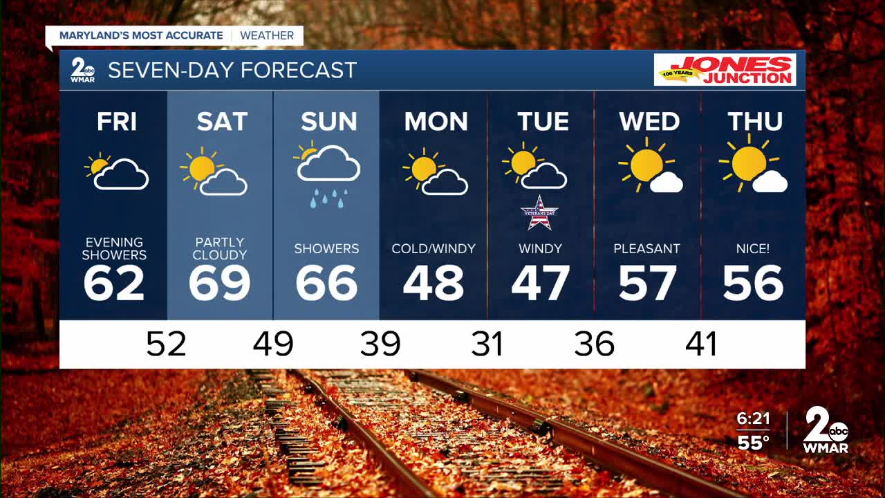
7 Day Forecast:
Friday Increasing clouds, with a high near 63.
Friday Night Showers likely. Mostly cloudy, with a low around 53.
Saturday Mostly sunny, with a high near 69.
Saturday Night Partly cloudy, with a low around 49.
Sunday A chance of rain. Partly sunny, with a high near 69.
Sunday Night A chance of rain. Mostly cloudy, with a low around 37.
Monday Partly cloudy, with a high near 46.
Monday Night Mostly clear, with a low around 31.
Veterans Day Partly cloudy, with a high near 48.
Tuesday Night Partly cloudy, with a low around 36.
Wednesday Mostly sunny, with a high near 58.
Wednesday Night Partly cloudy, with a low around 43.
Thursday Mostly sunny, with a high near 56.

