


BALTIMORE — Good Tuesday evening!
We are watching a cold front which will slide through the region Wednesday. This front will bring an increased coverage of showers to the region! Rain is most likely during the late afternoon to early evening hours.
Our attention quickly turns to Hurricane Erin, which has weakened to a category 2 storm. Erin will bring waves 8-12" ft to the Maryland coast Thursday & Friday along with gusty winds.
Forecast models show winds between 15-25 mph Thursday!


The two best days of the week will be Friday and Saturday as high pressure returns! Temperatures migrate back to the low-mid 80s along with plenty of sunshine.
The pattern turns active by Sunday with another cold front expected to bring storms back to the Mid-Atlantic.

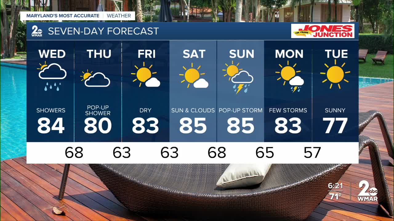
7 Day Forecast:
Wednesday A slight chance of showers and thunderstorms. Mostly cloudy, with a high near 81.
Wednesday Night A chance of showers and thunderstorms. Mostly cloudy, with a low around 68.
Thursday A chance of showers. Partly sunny, with a high near 80.
Thursday Night A chance of showers. Partly cloudy, with a low around 63.
Friday Sunny, with a high near 83.
Friday Night Mostly clear, with a low around 63.
Saturday Mostly sunny, with a high near 85.
Saturday Night Partly cloudy, with a low around 68.
Sunday A chance of showers. Partly cloudy, with a high near 85.
Sunday Night A chance of showers. Partly cloudy, with a low around 65.
Monday Partly cloudy and a chance of showers. A high near 83.
Monday Night Mostly clear, with a low around 57.
Tuesday Sunny, with a high near 77.

