


BALTIMORE — Our warming trend will continue into Thursday and Friday thanks to a more southerly flow bringing in warm and moist air. Temperatures will be in the low 70s and upper 60s. While the temperatures warm up another wet weather maker moves in and brings rain showers for Friday and Saturday. Once the rain and cold front clear through on Saturday afternoon, the cooler air begins to funnel in and cap our temperatures back into the low 60s well into the new work week.
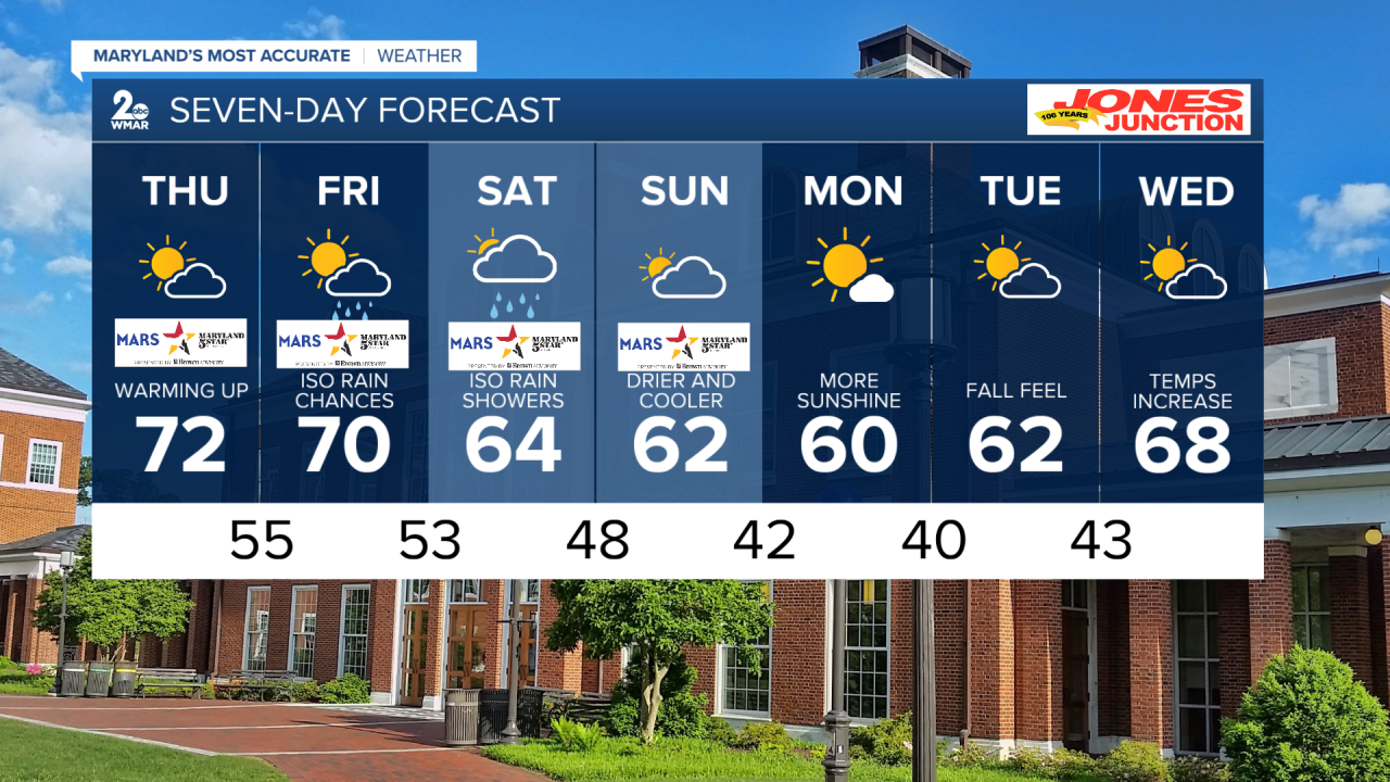
7 day forecast
Tonight Partly cloudy, with a low around 48. Light south wind.
Thursday Mostly sunny, with a high near 72. South wind 5 to 11 mph.
Thursday Night Mostly cloudy, with a low around 55. South wind around 10 mph.
Friday A chance of showers, mainly after 2pm. Partly sunny, with a high near 70. South wind 7 to 11 mph. Chance of precipitation is 40%.
Friday Night Showers likely, mainly between 8pm and 2am. Mostly cloudy, with a low around 53. Chance of precipitation is 60%.
Saturday A chance of showers before 2pm. Partly sunny, with a high near 64. Chance of precipitation is 30%.
Saturday Night Partly cloudy, with a low around 48.
Sunday Partly sunny, with a high near 62. Breezy.
Sunday Night Mostly clear, with a low around 42.
Monday Mostly sunny, with a high near 60.
Monday Night Mostly clear, with a low around 40.
Tuesday Partly sunny, with a high near 62.
Tuesday Night Mostly clear, with a low around 43.
Wednesday Partly sunny, with a high near 68.

