


BALTIMORE — Happy Friday!
Temperatures will plummet into the single digits with sub-zero wind chills expected early Saturday morning. The coastal storm will brush the Delmarva Peninsula this weekend, increasing winds, increasing the threat for some coastal flooding, and possibly producing a few inches of snow Saturday night into Sunday morning. The bulk of the snow will stay to the southeast of the Baltimore metro. Extremely cold and blustery conditions are expected on Sunday, before temperatures rise back above freezing next week!
Stay warm folks!
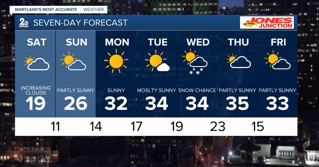
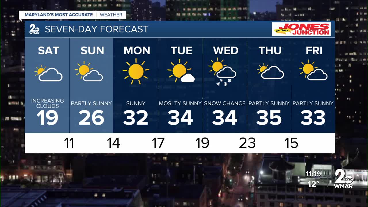
7 Day Forecast:
Today Mostly sunny, with a high near 20. Wind chill values as low as -7. Northwest wind 5-10 mph.
Tonight Partly cloudy, with a low around 4. Wind chill values as low as -7. Northwest wind around 5-10 mph.
Saturday Partly sunny, with a high near 19. Wind chill values as low as -8.
Saturday Night A slight chance of snow. Mostly cloudy, with a low around 11.
Sunday Mostly sunny, with a high near 26. Blustery.
Sunday Night Mostly clear, with a low around 14.
Monday Sunny, with a high near 32.
Monday Night Partly cloudy, with a low around 17.
Tuesday Mostly sunny, with a high near 34.
Tuesday Night Partly cloudy, with a low around 19.
Wednesday A chance of snow. Partly sunny, with a high near 34.
Wednesday Night A chance of snow. Mostly cloudy, with a low around 23.
Thursday Mostly sunny, with a high near 35.
Thursday Night Partly cloudy, with a low around 15.
Friday Partly sunny, with a high near 33.

