


Good Tuesday night!
Sunshine returns on Christmas Eve, making it a great day to squeeze in some last-minute shopping or travel. It will be windy on Wednesday, especially during the morning hours, with gusts exceeding 30 mph.
We’re tracking not one, but two weather systems that will impact the region later this week. The first will brush past southern Maryland on Christmas morning, bringing a chance for light rain showers to the area.

The second system, expected Friday, features a more complex setup. A warm front is forecast to stall across Maryland, allowing cold air to remain trapped near the surface while warmer air moves in above it. This type of pattern can support freezing rain and/or sleet. At this time, the most likely timing appears to be Friday evening, which could lead to slick travel conditions.
We’re still about three days out, so the exact track and impacts may change. Be sure to stay tuned for updates as we continue to refine the forecast.


Tuesday Night Mostly cloudy, then gradually becoming clear, with a low around 40.
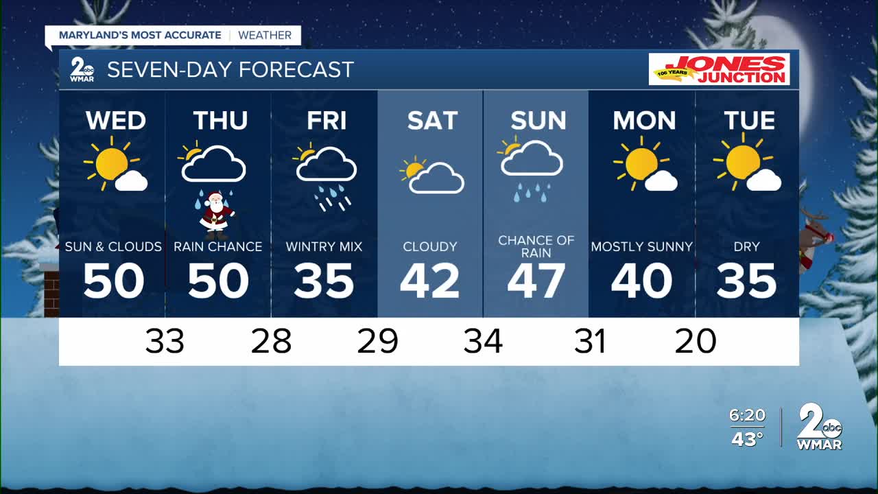
Wednesday Increasing clouds, with a high near 50.
Wednesday Night A slight chance of rain and snow. Mostly cloudy, with a low around 34.
Christmas Day A chance of rain. Mostly cloudy, with a high near 50.
Thursday Night Mostly cloudy, with a low around 31.
Friday Rain, snow, and freezing rain. High near 38.
Friday Night Rain. Low around 33.
Saturday Cloudy, with a high near 45.
Saturday Night A chance of rain. Cloudy, with a low around 29.
Sunday A chance of rain. Cloudy, with a high near 51.
Sunday Night A chance of rain. Mostly cloudy, with a low around 25.
Monday Mostly sunny, with a high near 32.

