


BALTIMORE — Good Tuesday night!
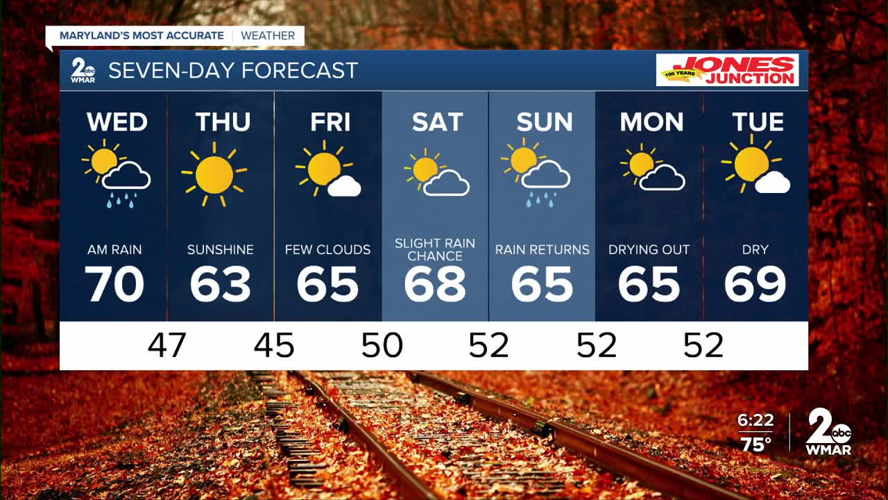
Rain is moving in tonight, and will last through sunrise Wednesday. The heaviest rain will fall between midnight-6am, with showers ending before 9am. Rain amounts will fall between 1/4" to 3/4" inch.
Winds will be blustery Wednesday as the cold front slides through, with occasional gusts to 25 mph!


The winds switch to the north Wed night - ushering in colder air by Thursday morning!! Grab the sweaters and jackets, as morning lows will be in the 40s!
The pick of the week will be Thursday, as strong high pressure and low humidity will lead to BEAUTIFUL weather!
We are carefully monitoring a coastal storm system Saturday night into Sunday. This storm has the potential to bring another round of rainfall to Maryland. Models differ on the track of the storm, and most models take the bulk of the rain out to sea, but a slight shift westward could increase our rain chances, so we'll keep you posted!

7 Day Forecast:
Wednesday Showers ending before 9am. High 70.
Wednesday Night Mostly clear, with a low around 47.
Thursday Sunny, with a high near 63.
Thursday Night Clear, with a low around 45.
Friday Sunny, with a high near 66.
Friday Night Partly cloudy, with a low around 50.
Saturday Partly sunny, with a high near 68.
Saturday Night Mostly cloudy, with a low around 52.
Sunday Partly cloudy, with a chance of showers. A high near 66.
Sunday Night Partly cloudy, with a low around 52.
Columbus Day Partly cloudy, with a high near 67.
Monday Night Partly cloudy, with a low around 52.
Tuesday Mostly sunny, with a high near 57.

