

Good Friday night!
Winter Weather Advisories have been posted for most of Maryland Friday night as a light wintry mix is expected throughout the area. Here's what we know:
• Wintry Mix (sleet/freezing rain) is likely before 10 PM Friday.
• Slick spots on roadways are likely.
• Treacherous travel is expected north into Pennsylvania, New Jersey and New York City Friday nigh into Saturday morning.

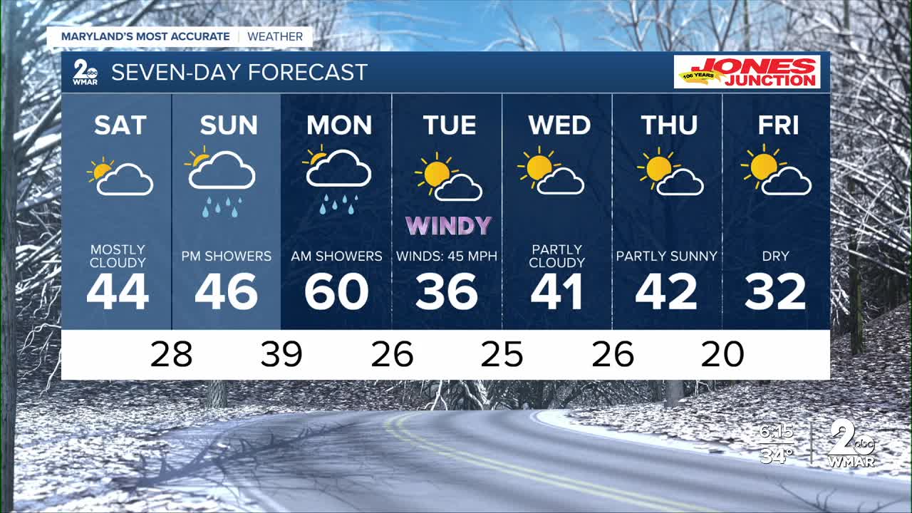
The weather dries out by Saturday, but the clouds remain stubborn through the afternoon, with a few peeks of sun here and there.
Our next chance of rain arrives Sunday night into Monday morning, as a strong storm system will bring gusty winds and a surge of cold air back to our region.

Friday Night Rain and sleet before 10pm, then a chance of rain. Low around 34.
Saturday Mostly cloudy, with a high near 41.
Saturday Night Mostly cloudy, with a low around 33.
Sunday A chance of rain, mainly after 1pm. Cloudy, with a high near 46.
Sunday Night A chance of rain. Cloudy, with a low around 42.
Monday Rain, mainly before 1pm. High near 56.
Monday Night Partly cloudy, with a low around 29.
Tuesday Mostly sunny, with a high near 36.
Tuesday Night Partly cloudy, with a low around 27.
Wednesday Partly sunny, with a high near 41.
Wednesday Night Partly cloudy, with a low around 29.
New Year's Day Partly sunny, with a high near 41.

