


BALTIMORE — After a week and a half of dry weather, some much needed rain returns to Maryland!
Tuesday will start dry, with increasing clouds by the early afternoon. Ahead of the front, southerly winds will allow temperatures to rise near 80°!
A robust front slides through Tue night, delivering widespread rain and even some heavy downpours. Most areas will receive between a half inch to an inch of rain by Wednesday morning. The heaviest of the rain occurs between midnight and 9am Wednesday.

Following the front, you can expect dry weather for the remainder of the week. Our next chance of rain holds off until Sat night into Sun morning as we are tracking a potential coastal storm.


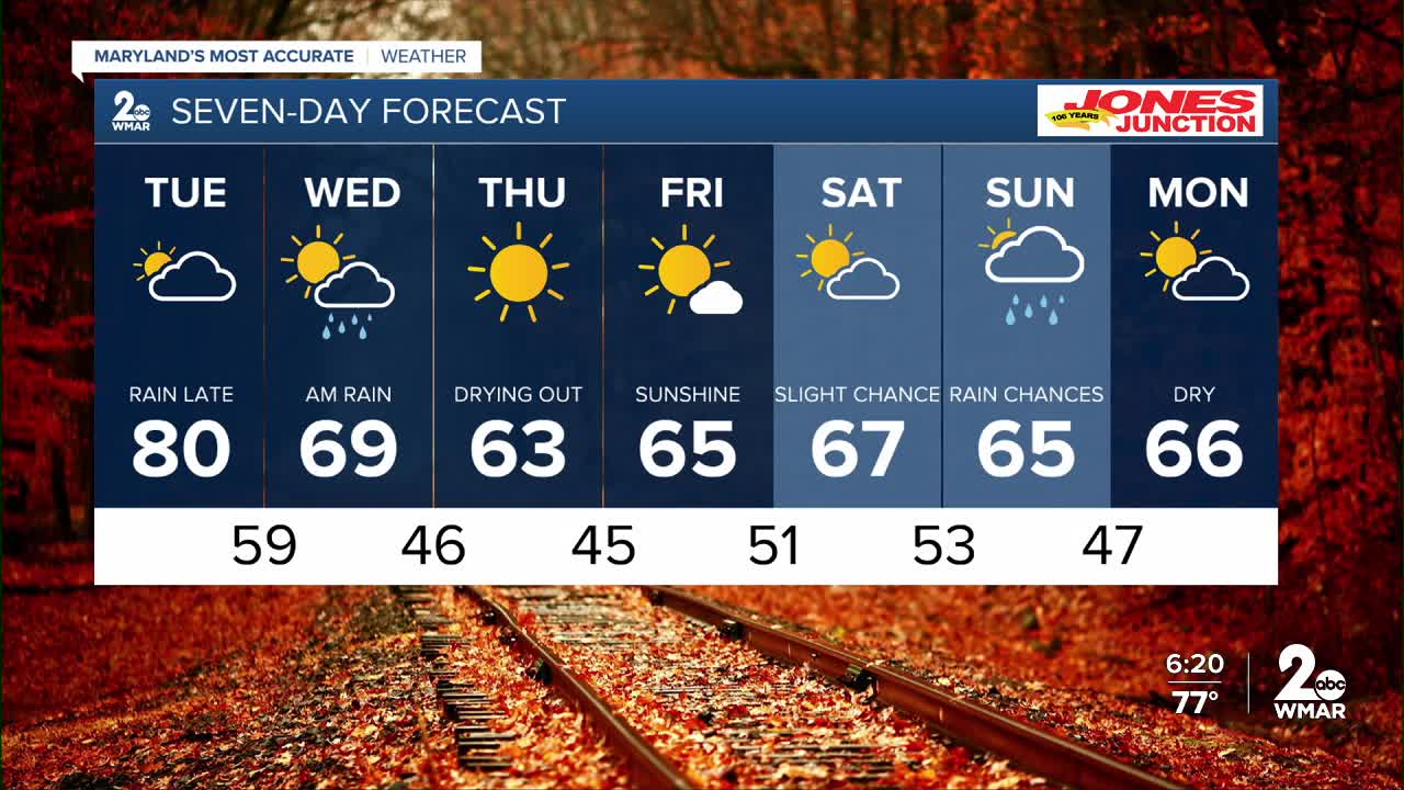
7 Day Forecast:
Tuesday Increasing clouds, with a high near 79.
Tuesday Night Showers likely, then showers and possibly a thunderstorm. Low around 60.
Wednesday Showers. High near 70.
Wednesday Night Mostly clear, with a low around 46.
Thursday Sunny, with a high near 63.
Thursday Night Mostly clear, with a low around 45.
Friday Sunny, with a high near 66.
Friday Night Partly cloudy, with a low around 51.
Saturday Mostly sunny, with a high near 69.
Saturday Night Partly cloudy, with a low around 53.
Sunday Mostly sunny, with a high near 68.
Sunday Night A chance of showers. Mostly cloudy, with a low around 47.
Columbus Day A chance of showers. Partly sunny, with a high near 68.

